Topic
Mountains to Sea Trail, NC. Sections 9-12
Forum Posting
A Membership is required to post in the forums. Login or become a member to post in the member forums!
Home › Forums › Campfire › Member Trip Reports › Mountains to Sea Trail, NC. Sections 9-12
- This topic is empty.
-
AuthorPosts
-
Apr 3, 2011 at 8:22 am #1271627
My in-laws have been trying pretty hard to convince us to move to North Carolina to be closer to family. After blindly resisting for years, it occurred to me that all I know of NC is what I’ve seen from the car window during Christmas visits, so I decided to experience the state for myself. In December, I started soliciting opinions from the BPL community for a 3-4 day hike that would showcase the best that NC had to offer. Many good options were suggested and I ultimately decided on the Mountains to Sea Trail, sections 9-12. At approximately 100 miles in length, it was a little longer that what I ‘d originally had in mind, but it offered such a varied terrain of peaks, ridges, and gorges that I felt it was exactly what I was looking for.
The adventure started for me in January. Having lived in Michigan for the last 7 years, I worried that the unaccustomed changes in elevation would limit my ability to finish the trip in the time I had allotted (4 days max). I changed my daily workout regimen to include stair running with a pack, incline/decline treadmill with a pack, a long trail run, a shorter run with intervals, and even lunch hours on the dreaded (yuppy) elliptical trainer at a gym near work for convenience. Picture an aging long-haired guy sweating alongside a line of college girls- that was me. The thing is, every time I did one of these workouts, I was visualizing myself in the mountains and it kept me motivated.
As the date approached, I again solicited help from the forums. I planned to leave my car at Beacon Heights Overlook where my trek would end and needed a shuttle to the starting point at Balsam Gap. Scott Waldrop, one of the members that had helped my select my route immediately stepped up and volunteered to drive me. At the time, I had no idea what this would entail.
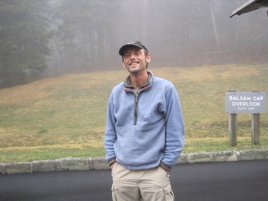
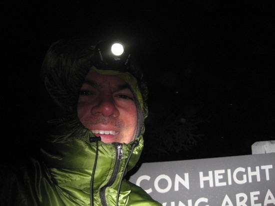
Finally the day arrived. On Sunday, March 27th, I made the drive to North Carolina, arriving at the Carroll Gragg parking area near Beacon Heights in the middle of the night. I caught a few hours of sleep in the back of my car and Scott picked me up a little before 8:00 in the morning. Just to tell you a little about Scott, he is one of the most easygoing and balanced people I’ve met; a professional, a photographer, a singer, a philosopher (my interpretation, not his), and a genuine trail angel. As we drove, he talked about trail conditions, routes, and a variety of other topics, immediately calming my pre-trip jitters. A note of genuine gratitude here- as it turned out, the Blue Ridge Parkway and many of the smaller roads nearby were closed due to adverse weather conditions and Scott spent over four hours attempting various routes before finally getting me to Balsam Gap. Including the time it took to get home, he must have spent over 7 hours on the road that day, asking nothing in return but that I enjoy my experience on the trails he knew. He refused any sort of repayment, believing in karma, fate, or what goes around comes around. For his sake, I hope it does. Knowing that there are people like Scott around makes the world seem like a better place.

Trail Angel: Scott W
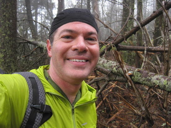
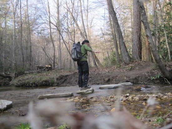
I said my goodbyes at the trailhead and took off up the trail, immediately starting to climb towards Blackstock Knob. It was foggy and drizzling with limited visibility. Nearing the top, it suddenly started to hail, or so I thought. Looking up, I realized the trees were all frozen and when the wind blew, ice chunks were dislodged.
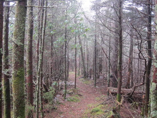
The trail began to drop back down towards NC-128.
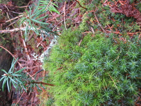
This moss patch reminded me of a tropical island with palm trees
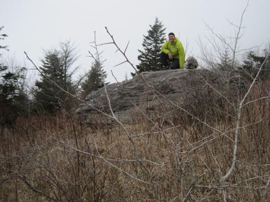
I couldn't resist the urge to stop and play around on some rocks.
Soon the trail itself became a rocky path.
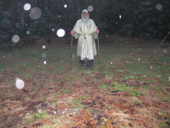
Arriving at the road, I looked at my watch and realized that it had taken me almost 3 hours to cover 5 miles. I was going to have to do much better if I planned to finish this trip in time. Mount Mitchell was up next and I began to climb in earnest. Given the late start to the day, I wanted to make sure that I wasn’t stuck on the peak when night fell. As I climbed, the character of the landscape began to change. Starting as a green tunnel of rhododendron down low, the trail gradually led through a conifer forest dominated by large Spruce and Fir trees until I reached the peak at around 5:30. There, I was a little disappointed to find a parking lot, concession stand (closed), and observation tower. It was snowing now, and the blowing wind cut through my layers effortlessly. A little sign pointed out that the summit of Mount Mitchell was the coldest point in the Southeast. Thanks, Captain Obvious!
A man in a pickup truck seemed concerned to find me up there alone so late in the day and kindly offered me a ride down. I assured him that I was fine and would be heading down soon. I took off down the trail wanting to be off the mountain before nightfall.
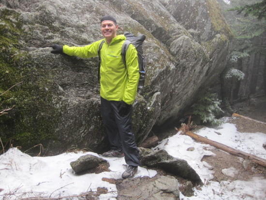
Standing in the snow on Mount Mitchell
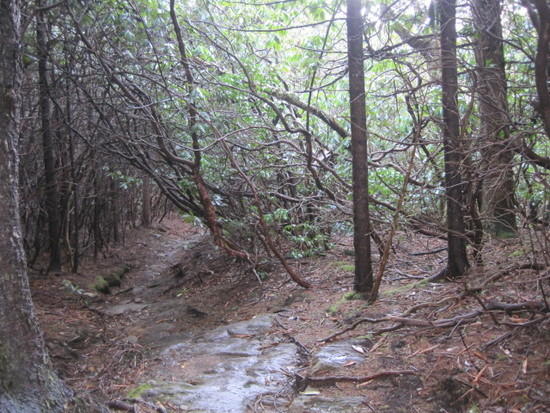
Re-entering the green tunnel on the way down
The trail down was fairly well graded and I was able to move quickly, running when conditions permitted. I soon passed Commissary Hill, a grassy meadow that looked like a fantastic place to camp, but there was still light left in the day and I continued on. At dusk, as the rain started to pick up, I set up camp in the woods just past Higgins Bald.

Dinner was a mediocre linguine, enhanced with tasteless chunks of TVP and olive oil. Not feeling particularly hungry, I ate it all anyway, knowing that calories would become critical in the next few days. I listened to the rain drops hitting my tarp for a while before drifting off. It was a cold night.
Staring point: Balsam Gap
Ending point: Somewhere past Higgins Bald
Time spent hiking: 7 hours
Distance traveled: approx. 14 milesDay 2
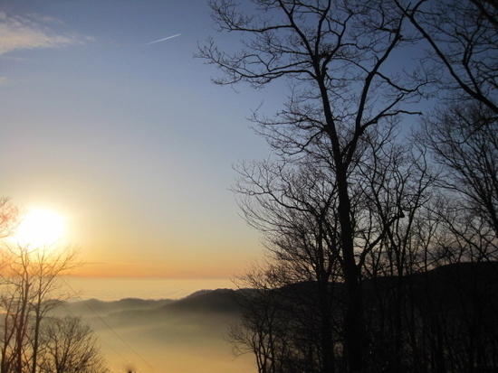
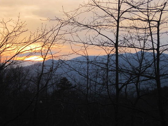
I awoke at 6 am to a beautiful dawn. I started water boiling while I broke camp, and scarfed down some sort of rehydrated egg and bread breakfast casserole doused with olive oil before heading out. It wasn’t bad, but extra virgin olive oil makes everything better.As I walked, I caught glimpses of amazing scenery through the trees, but couldn’t find a clearing to photograph it until I came to some powerlines. Suddenly, an ocean of clouds and mountain islands spread out before me.
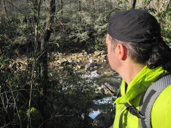
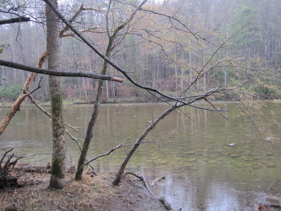
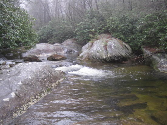
Soon I reached the Black Mountain campground, still closed for the season. The bathrooms were locked, but they did have bear proof trash bins, so I got rid of my used freezer bags. I walked past a pretty stream (the South Toe River) that looked “fishy”, crossed a bridge, and entered the Pisgah National Forest, passing the ruins of some old buildings.
Looking out over the South Toe. Sure to be trout in there
The ruins
Their presence seemed fitting. As Scott and I had talked about the day before, once it’s been there for long enough, evidence of former human habitation leaves the realm of “ forest intrusion” and becomes “history”. I was soon climbing again, this time toward Big Laurel Mountain.
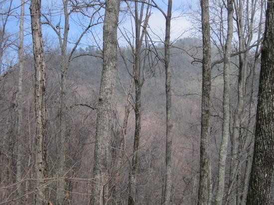
As I switchbacked upward, I had a great view of this mountain chain in front of me, dotted with clouds.
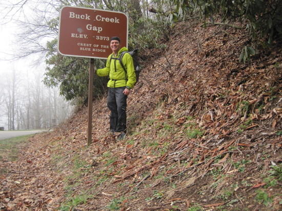
Soon I was in my own clouds though, a cold, thick mist that again blocked view. I walked through forest and along ridgeline, until a couple hours later I descended to cross the Blue Ridge Parkway. The trail paralleled the parkway a short distance before dumping me out at Buck Creek Gap, the end of section 9.
As I stood by the signpost studying my maps of section 10, a young guy stopped his car to see if I needed help. I was definitely feeling the kindness of strangers in this part of NC.
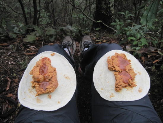
Breaking for some cold bean burritos on the trail. It’s amazing how some not completely rehydrated beans and taco sauce can taste. Trail happiness is sometimes all about the little things.
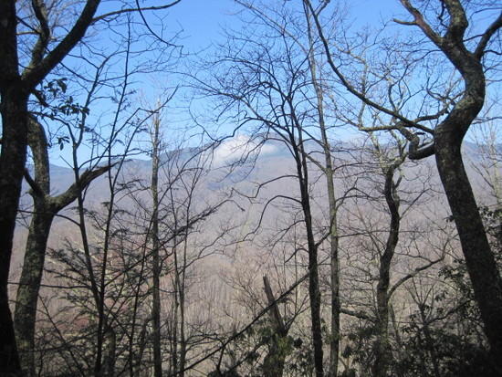
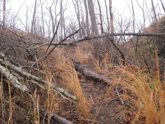
Section 10 started with a pleasant climb to an unnamed summit then followed timber ridge. I was below the clouds again and catching some nice views. Soon though, the trail conditions deteriorated. It looked like someone had driven a backhoe along the trail, clearing a wide two-track. The ground was torn up and littered with cut trees and branches. I wasn’t sure why the trail maintainers felt the need for such a wide cut, but the amount of horse manure in this section suggested that maybe it was to accommodate equestrian traffic as well.
This picture doesn’t really show the extent of the damage I was seeing.
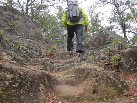
As I followed the ridge, I saw a pretty mountain off to the side. Little did I know that I would soon be climbing to its peak. The climb up Woods Mountain was challenging and I’m not ashamed to admit that I had to claw my way up some of the steep pitches on all fours, leaning into my poles. I came to the conclusion that 3 hours on a treadmill with a max incline of 15 degrees did little to prepare you for 14 hour days climbing and descending 30-40 degree pitches. Once up though, I had a nice run along Betsy Ridge before descending to Tom’s Creek.
I made up a lot of time in this section, ultimately arriving in good spirits at the Woodlawn Work Center, end of section 10. It was now about 6 pm.
I crossed the road and followed the trail along a dirt road until I came to a parked red pickup truck with a confederate flag imprinted on the rear window. It was taking up the whole path in front of me, and as I stopped to stare it dawned on me that the truck was rocking up and down. There was really no way around it, so I headed forward again, trying to squeeze around the truck. Maybe its occupants wouldn’t notice me; that truck was really bouncing now! My shoulder barely brushed the side view mirror as I rushed past. I kept my eyes averted, but it was hard not to notice what the occupants were up to. As I moved on up the trail, the center of my back tensed, waiting for the inevitable shotgun blast. I decided to make some extra miles this evening, just in case Romeo decided he hadn’t had enough fun for the night and decided to go home and get the coonhounds.
Soon my anxiety faded and I was feeling pretty good about myself. I had finished sections 9 and 10 today. Just then, an older man and his dog blasted past me on the trail. As he went by, the guy asked where I was headed. “Beacon Heights”, I replied, hoping he’d be impressed. “Never heard of it”, he said as he rushed on. “He’s not carrying a pack, and probably hasn’t already done 25 miles today”, I feebly rationalized to myself as the man and his dog faded out of sight.
As I hiked on, the sun set behind the mountains.
I continued until after dark, finally stopping to set up camp in a small clearing in the woods by a meadow. Dinner was a good lasagna, again doused with olive oil. I also dipped into my alcohol stove fuel for a little nightcap, mixing it with a titanium mug of pink lemonaid.
Starting point: Somewhere past Higgins Bald
Ending point: A couple miles before the Catawba River
Time spent hiking: 13 hours
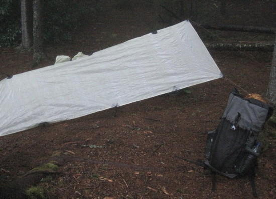
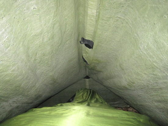
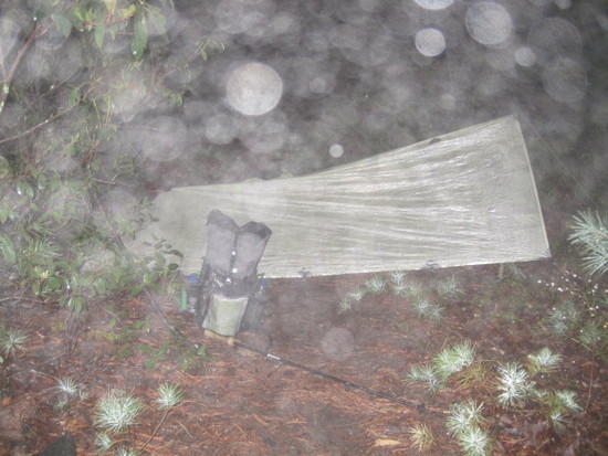
Distance traveled: 24 milesThat night, the skies opened up and it began to pour. Lightening lit up the skies. I briefly worried about the size and velocity of the raindrops, and whether the limited hydrostatic head capabilities of my poncho tarp would be enough to keep me dry. Then I remembered that I was sleeping beneath an awesome piece of SUL gear, and besides, I was an ultralight hiker, comfortable with the idea of compromise. For reassurance though, I touched the inside of my tarp and it was bone dry. Good enough for me. I fell back asleep until 5 am.
Secure under my poncho tarp
Day 3
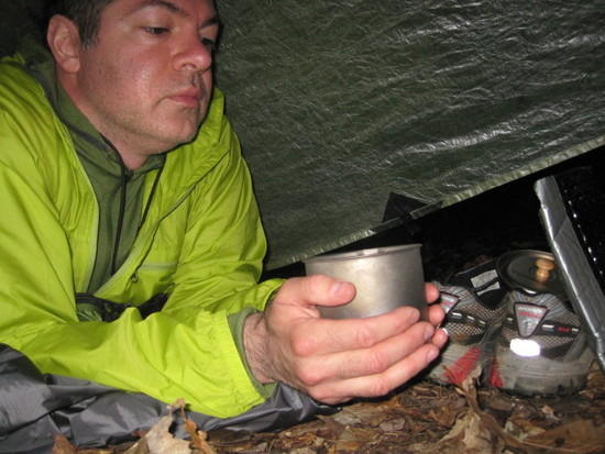
Still in my sleeping bag, I lit my stove and boiled up a pot of water for coffee and breakfast. The rain was still coming down in sheets, so I drifted back off to sleep for an hour, hoping it would slow. At 6:15, I bit the bullet, packed my gear, and broke down the tarp, getting wet in the process. I hit the trail and soon reached the Catawba River.
Crossing the bridge, I found myself climbing toward Bald Knob. The rain slowed and I shed my poncho, figuring a windshirt would be enough to handle the constant drizzle.
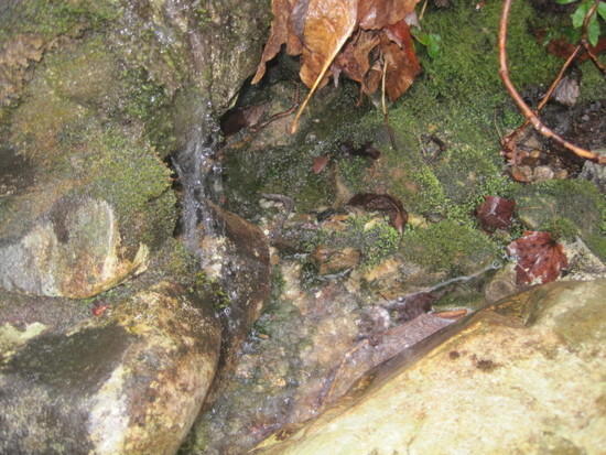
Stopping to fill water bottles at a small spring.
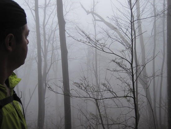
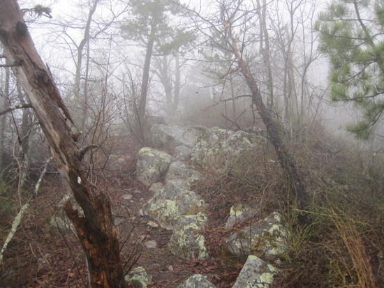
As I gained elevation, the fog closed in again, opening periodically to reveal amazing rock formations. Vision was limited, but the lighting was unreal.
Reaching the mountain top, the trail became a rock scramble, with wind and fog intensifying the conditions.
Descending to more amenable conditions, I against strove to make up time.
Soon I was climbing again, this time toward the pinnacles. I had thought to be at the Linville River by now, but seemed to be moving in slow motion again.The Pinnacles
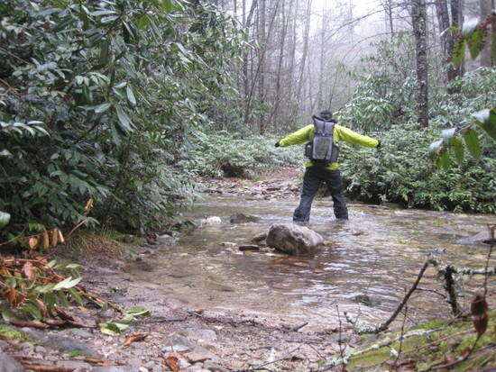
Fording the Linville River. You can just make out the white blaze on the far bank. The river was wide and numbingly cold.
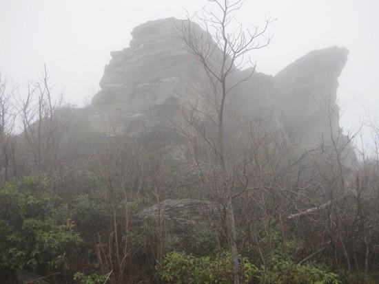
Crossing the Linville River, I was immediately confronted by Shortoff Mountain. It appeared that the whole mountain had been involved in a major burn. The trail was littered with the burnt corpses of large trees, necessitating frequent scrambling over or under, and waist high grass grew everywhere. It looked like something out of the apocalypse. Climbing higher, that feeling was reinforced as the mist closed in again. The top of Shortoff was spectacular, with spectral trees and massive rocks sticking up out of the fog.
The scramble up Shortoff
Fog closing in again
Reaching the top of Shortoff. I wish I had framed that tree to the left.
The trail followed a long ridgeline then descended toward a valley. I knew that I would soon be climbing again toward the next set of peaks, the Chimneys, a section that would span about 5 miles. It was getting darker now and I had another moment of anxiety. I was tiring now, and if the trail conditions were like Shortoff, I could find myself stuck at the top when darkness hit. Getting lost in the dark or caught in a lighting storm on the exposed peak were not high on my to-do list. I thought about setting up camp in the sheltered valley and attempting the peak in the morning, but knew if I did this I would never complete the trek in time.
Looking exhausted
Glancing at my watch, I saw that it was only 5:30. I could make it. With renewed energy, I attacked the mountainside, hauling myself toward the top.
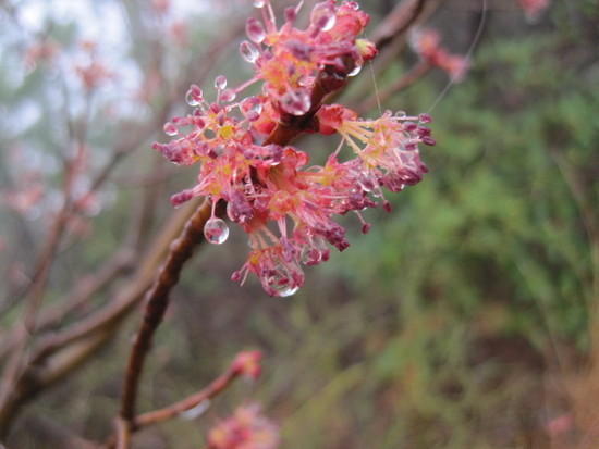
Midway through the climb, these spring blossums lifted my spirits, promising good things to come.
I reached the peak and was greeted with the most amazing sight of the day. Looming out of the fog was a huge stone monolith and an ancient tree, looking like something out of a Chinese painting. This picture does not do justice to the magnificence of that scene.
I followed the path still gaining elevation, seeing fantastic rock formations. Some of the rocks took on almost human shapes. Wait, those were two women standing in the mist. Looking closer, I noticed they weren’t wearing coats or packs. “How did you get up here?” I stuttered. “The parking lot over at Table Rock”, one of them answered. Seeing my crestfallen face, she said, “I guess that wasn’t the right answer”. They asked if I was a Mountains to Sea hiker and wanted to know where I started that morning. I don’t know if it was exhaustion, or the surprise at seeing them, or the fact that I had poured out my soul on the side of that mountain, but I was having trouble coming up with answers quickly. Finally, I told them and they seemed impressed with the answer. They said that they were members of a weekend hiking club and it was a pleasure to meet a real long-distance hiker, I guess referring to me. Not wanting to seem like more of a dimwit than I already had, I exchanged goodbyes and took off, reaching Table Rock a mile later.
Now I was flying down the mountainside. Almost literally, because I soon slipped on a slick rock and ended up on my backside, breaking the tip off one of my trekking poles in the process. The one time I fell and somehow the tip had lodged in a forked root as I went down. &@#! I dusted myself off and resumed my run down toward Steels Creek. Once it got dark, I put on my headlamp and continued, finally setting up a stealth camp in a little clearing just off the trail at about 9 pm.
It was still raining and I was pretty wet once I got my poncho set up. I put all my wet clothes under my bivy and slipped into the dry shirt that had been taking up space in my pack to this point. Heaven. I cooked dinner in my sleeping bag, a pot of chili flavored Ramen liberally coated with olive oil, and it was awesome. Too tired to bear bag, I used my food sack as a pillow.
Starting point: 2 miles before the Catawba River
Ending point: 2 miles before Steels Creek
Time spent hiking: 14.5 hours
Distance traveled: 26 milesDay 4
The next morning saw me through Steels Creek, Upper Creek, Raider Camp Creek, Harper Creek and Gragg Prong, again in the rain and fog. This was a fly fisherman’s paradise. Everywhere were waterfalls, pools, riffles, and runs. Unfortunately, I had to be off the trail by that night, and didn’t have time to explore the side trails as I would have liked. The going was also particularly slow around each creek as the trail passed over slippery rocks and fallen trees and I had to be very careful with foot placement.The first of about 30 stream crossings this day.
Deep water crossings became more and more frequent. In the Harper Creek area, after the fifth time that I had crossed the same stream in a ½ mile stretch, I finally started cursing the trail builder. “What! Are you kidding me? How many times do you want me to ford this same darn (profanity filter) stream? Pick a side!” Watching the time, it was becoming more and more apparent that I wouldn’t reach the trailhead before dark. That was ok. Today would be epic.
I stopped briefly for another bean burrito lunch (favorite trail food) and felt a renewed sense of energy. I again started running the flats, rare though they were to make up for time lost in the drainages. The occasional dirt road walks in this section were a welcome relief from the ruggedness of the trail.
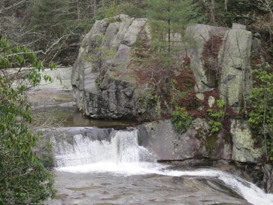
Small waterfall
I knew that the final 10 miles climbed toward Beacon Heights, and my mantra became “up not down”. Each time the trail headed downward toward a new creek, my mood would fall, rising again with each upturn in the trail. Finally at about 5 pm, the trail became a steady upward climb. At 7 pm, as if by magic, the rain stopped and the mists parted to reveal a clear blue sky. The trail was now following a wide two-track and I felt like the heavens were smiling down on me. The sun went down, and for the first time on the trip, I saw stars. The big dipper seemed very close to me, twinkling brightly.
As it turned out though, the heavens weren’t smiling, they were smirking. Out of nowhere, the winds picked up and I found myself hiking in a snowstorm. It got so cold that I ended up hiking in my cocoon pullover, pulling hands into sleeves to keep them from freezing. Three hours later, the trail suddenly dumped me out at trail’s end. I then backtracked about 0.5 miles to the unmarked side trail that took me back to my car on Carroll Gragg Road. It was 11 pm.
Starting point: 2 miles before Steel Creek
Ending point: Carroll Gragg Road
Time spent hiking: 17 hours
Distance traveled: 29.5 milesI drove through North Carolina, Tennessee, and Virginia, stopping at a truck stop, the only open place I could find, for the most awesome double cheese burger in the world. I then caught a few hours of sleep in the back of my car.
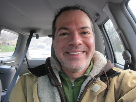
The next morning, I found a small diner and ordered breakfast. Two eggs over easy with sausage, toast, and hashbrowns, two biscuits with gravy, and a side of corned beef hash. The waitress brought out three platters, apologizing that the cook had accidentally made 3 eggs instead of two. “No problem”. An overweight couple was sitting across from me morosely sharing a salad. As I cleared my second plate, I heard the husband say quietly, “Just don’t look at him.” Funny thing was, even after the last plate was wiped clean, I never felt full. (BTW, I ended up losing 5 lb on this trek)
Elated
Post trip thoughts: Finishing this trip in the manner I did was incredibly satisfying, and really exemplified for me the BPL motto, "Pack Less, Be More". There is no way I could have accomplished this trip with a heavy pack. I had planned and trained for this trip for 2.5 months, and the reality was even better than the anticipation. I felt like I got to experience an incredible diversity of NC wilderness in a short time- it’s hard to believe that all of these events took place in just 3.5 days.
This was one of the most fulfilling trips I’ve ever taken, and I’d repeat it in a heartbeat, with one caveat. As it turns out, mountain miles are not like Michigan miles, and it took me much longer to cover ground than the 2 miles per hour I was expecting. Because of this, I wasn’t able to experience the Wilson Creek Drainage as fully as I would have liked. This area was a treasure trove of secret spots and would best be enjoyed slowly and off trail. If I were in the area again, I’d love to spend a week just exploring sections 11 and 12, my two favorites, this time with a tenkara rod and no particular agenda.
Gear: I obsessed over my gear list in an effort to minimize pack weight and felt like I had everything I needed and nothing I didn’t. If interested, you can access this list on my profile. I was really happy with my last minute decision to throw in an extra shirt, given the weather forecast (30-40 degrees and rainy). This was a lifesaver, as I frequently chose to get a little wet rather than scramble up mountains in a poncho.
Apr 3, 2011 at 8:40 am #1719260Great trip report! You said it was one of the most fulfilling trips you've done and that really comes through in your words and pics!
Apr 3, 2011 at 10:07 am #1719292Love the pictures. I was just out in NC about a week ago doing a section of the AT thru GSMNP. I had a similar sunrise with the low lying clouds. I love southern Appalachia and I'm glad to hear you had a great time!
Apr 3, 2011 at 10:45 am #1719306Awesome report! I haven't done that section but that seems like a quintessential western NC trip! Its looks like you had an amazing time. There really is something special about the lichen covered trees in the fog and makes me so happy every time. Your words and photos reminded me of how much I love this area. Plus its great reading this through the eyes of someone from not around here.
Apr 3, 2011 at 1:26 pm #1719356Great Trip Report and Pics. Thanks for sharing!
Apr 3, 2011 at 1:31 pm #1719360Ike,
Glad you got to meet some of the nice folks in NC and experience such a pretty part of the country. I miss the misty, rhodi lined trails…it looked like a great trip. Thanks for sharing.
TomApr 3, 2011 at 1:53 pm #1719370Glad you made the trip, not sure it was the best intro weatherwise you could have had. We call it the typical Appalachian experience. You walked through and over some of the best views in the state, too bad you couldn't see them. Thanks for the report.
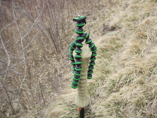
Apr 3, 2011 at 2:35 pm #1719389You are one hearty soul to cover the distance, over tough terrain, in tough weather conditions, and in record time. I'm amazed you had the time to take such awesome pictures. Was your camera ultralight? The technical quality appears to be topnotch, so I'd really like to know what you were using. Did you a gorilla pod or other device to position the camera?
Apr 3, 2011 at 2:50 pm #1719395Thanks you all for taking the time to read this trip report. I know it was a bit long- obviously this experience meant a lot to me.
Jim, I use a canon powershot SD1200 IS with a Joby gorillapod. With a homemade case it weighs 6.3 oz. I don't have a great deal of photography skill, so I compensate by taking a lot of pictures, trying various settings. I have to say that this time the pictures did not do justice to the amazing scenery I witnessed.
Apr 3, 2011 at 3:54 pm #1719430Great trip report Ike. Enjoyed the pictures and the read.
Apr 3, 2011 at 4:49 pm #1719455Very nice report.
Brad
Apr 3, 2011 at 4:54 pm #1719457I also wanted to say thanks for posting this great report.
Apr 5, 2011 at 7:00 am #1720222Great report-you hit some of my favorite spots. If you go to BPL member Alex H. website you can " armchair ramble " many other great hikes in our area.If you can hit these areas right after a front goes through the views are spectacular.
I liked your details on the food. Ronald Turnbull says"it's not what you eat, but where you eat it"Apr 5, 2011 at 8:31 am #1720245Hi Ike, glad you had a great time in WNC! it was a pleasure to meet and chat with you last week; hopefully our paths will cross again.
Oh and you're right about Wilson's Creek, it's paradise down in those gorges. I don't fish, but friends that do rave about the fishing there. You should see it when the rhododendron are blooming… Take care my friend!
Apr 5, 2011 at 8:41 am #1720249Thanks for sharing Ike. Looked like quite an adventure, congrats; all the planning, gear/food selection, logistics and then finally pulling it off. Didn't look like a walk in the park either, that diner must have seemed liked heaven.
Great trip report.
Apr 5, 2011 at 7:53 pm #1720700One of the best trip reports I've read in a long while . Felt like I was right there with you. Appreciate you sharing it.
Ed
-
AuthorPosts


- You must be logged in to reply to this topic.
Forum Posting
A Membership is required to post in the forums. Login or become a member to post in the member forums!
Our Community Posts are Moderated
Backpacking Light community posts are moderated and here to foster helpful and positive discussions about lightweight backpacking. Please be mindful of our values and boundaries and review our Community Guidelines prior to posting.
Get the Newsletter
Gear Research & Discovery Tools
- Browse our curated Gear Shop
- See the latest Gear Deals and Sales
- Our Recommendations
- Search for Gear on Sale with the Gear Finder
- Used Gear Swap
- Member Gear Reviews and BPL Gear Review Articles
- Browse by Gear Type or Brand.
