Topic
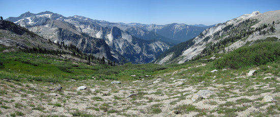
Sequoia & Kings Canyon: Deadman Canyon
Forum Posting
A Membership is required to post in the forums. Login or become a member to post in the member forums!
Home › Forums › Campfire › Photo Gallery › Sequoia & Kings Canyon: Deadman Canyon
- This topic is empty.
-
AuthorPosts
-
Oct 2, 2010 at 12:41 am #1263916
August 6th 2010 to August 10th 2010
5 Days, 51.5 Miles: 49.7 on trail, 1.8 off trail.
Daytime Temperatures: 55F to 75F
Nighttime Temperatures: 40F to 45F
Tom Harrison Map: Mt. Whitney High Country Trail Map
Lodgepole/Twin Lakes Trail Head
Starting Point Grids: 52 & 54 X 45 & 46Website: Sequoia & Kings Canyon National Park

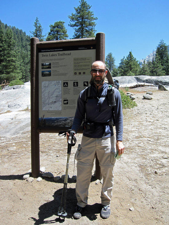
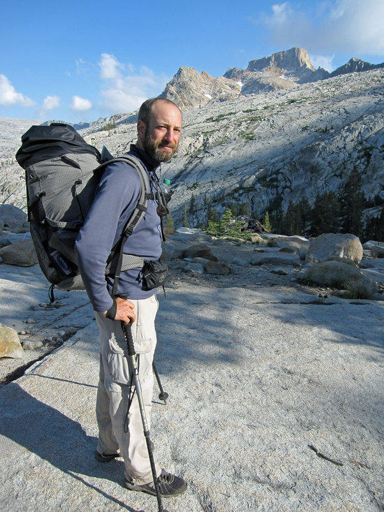
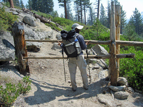
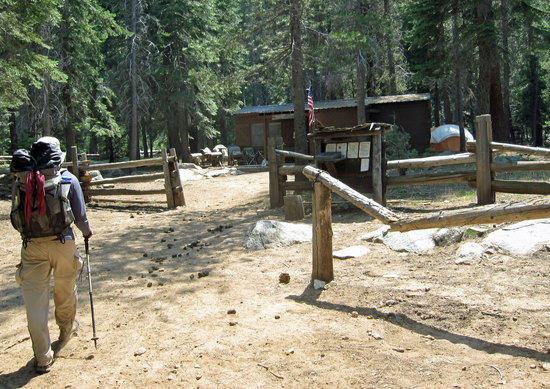
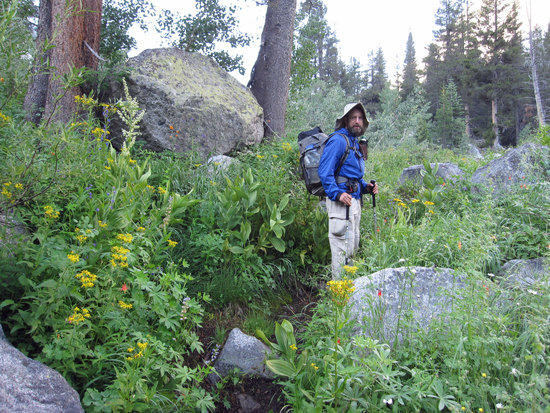
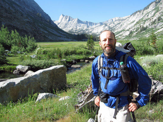
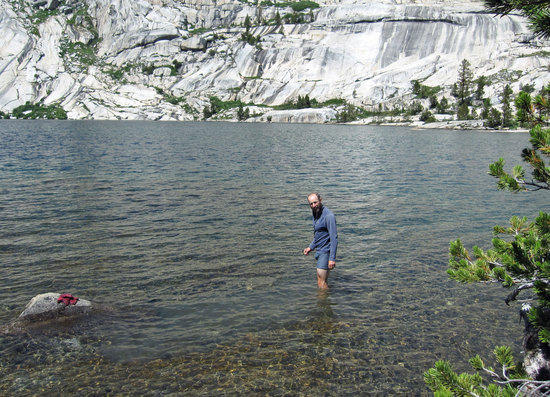
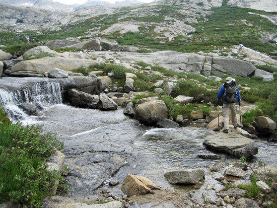
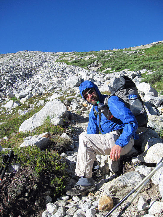
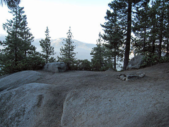
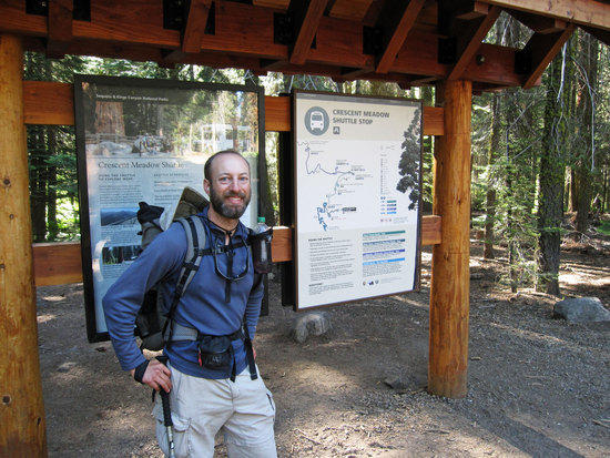
Jeremy at the Twin Lakes Trail Head
Elevation 6769 Ft.
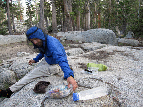
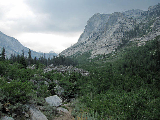
12:33pmOur journey started with waking up at 5am. Jeremy came by my house and we took my car from there, hitting the road at 6am. Once we headed into the step and winding roads to Sequoia National Park my coolant warning light started to flicker on and off. Pulling my car off to the side of the road and popping the hood open, I could see that I had lost over half of my radiator coolant in my reserve tank. Green fluid was not gushing out from under my car, but it was clearly slowly leaking out. Hitting the road once more, at a nearby gas station, I loaded up on expensive gas and Jeremy bought 1 gallon of radiator fluid at prices that only a tourist could appreciate. Filling up the radiator we continued on eager to get to Lodgepole. We arrived at the Ranger Station at about 11 am and were surprised at how relatively quickly we had made it. After picking up our wilderness permit at the Lodgepole Ranger Station/Vistor's Center, we took a casual lunch and then drove a short distance to the parking lot for the trail head, which was full of vehicles and car camping sites. Embarrassingly enough, we had trouble finding the Twin Lakes Trail Head and ended up going off towards a water fall that was close by. A German family of tourist actually pointed us in the right direction. The trail head literally was skirting the edge of the car camping sites. Happy to find the trail head, it was time to get dusty and moving!
Note: The Lodgepole Ranger Station & Vistor's Station has restrooms, a small grocery/gift store, cafeteria, laundry machines, and facilities for showering.

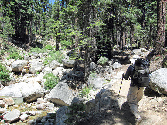
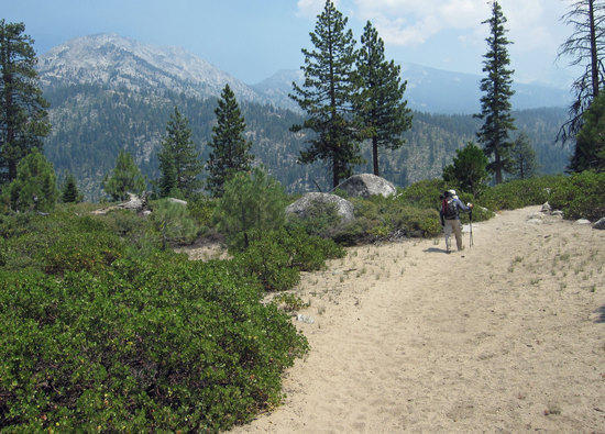
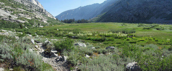
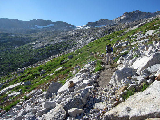
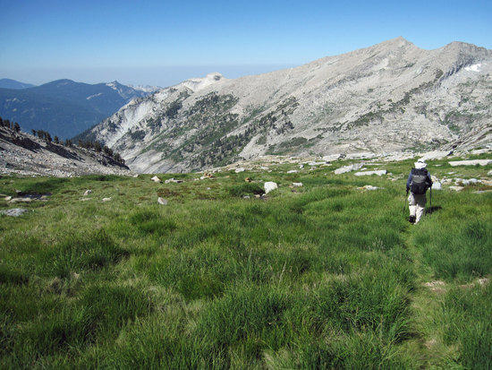
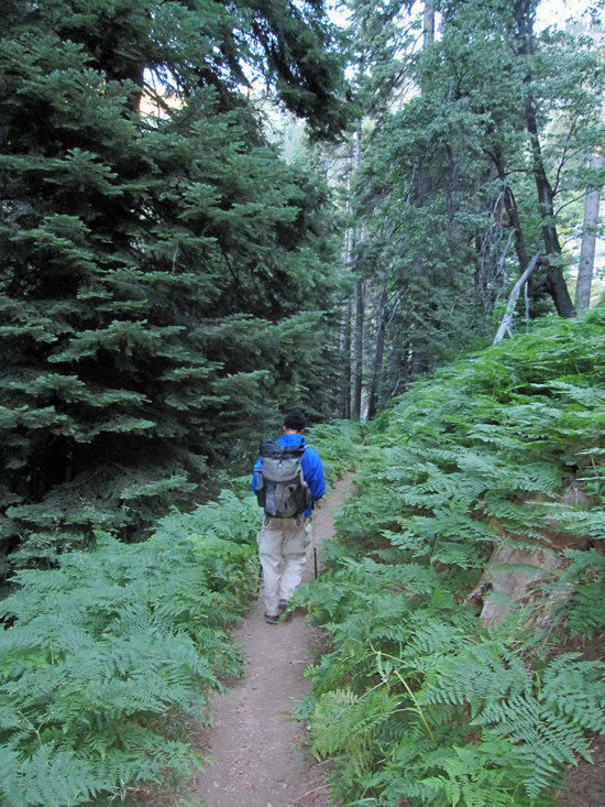
Getting Our Trail Legs Back
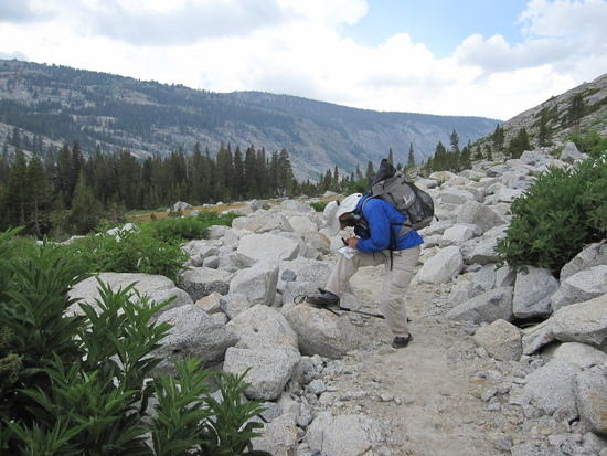
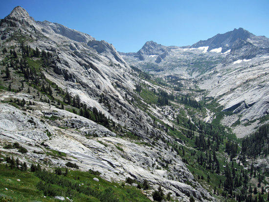
Leaving the Trail Head, over 0.7 Miles the trail quickly gained some altitude rising from 6769 FT. to 7240 FT.Jeremy Loads Up on Water at Silliman Creek
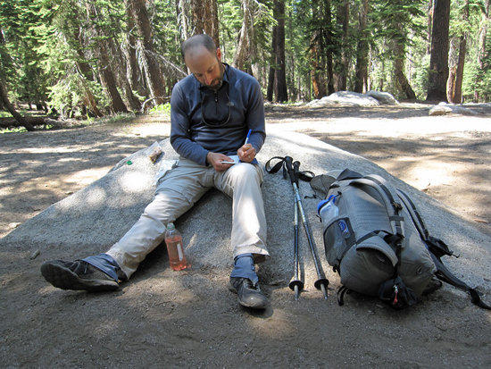
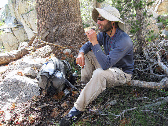
Elevation 7600 FT.Jeremy Taking a Snack Break & Jotting Some Notes Down at Cahoon Gap.
Elevation 8640 FT.Note: Jeremy is wearing Dirty Girl Gaitors in the hope that preventing any small debris, grit, and dust will save his feet from the blisters that he has come to expect. Mountain Laurel Designs (MLD) Exodus Pack with starting weight of 22 lbs. My GoLite Jam2 started out with about 28 lbs. Bear Canisters required. Jeremy's base weight hovers at about 8.5 lbs. Mine is at about 10-11 lbs.
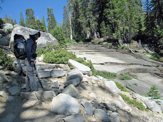
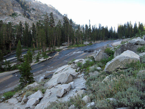
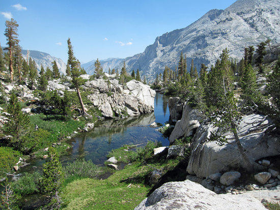
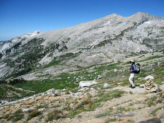
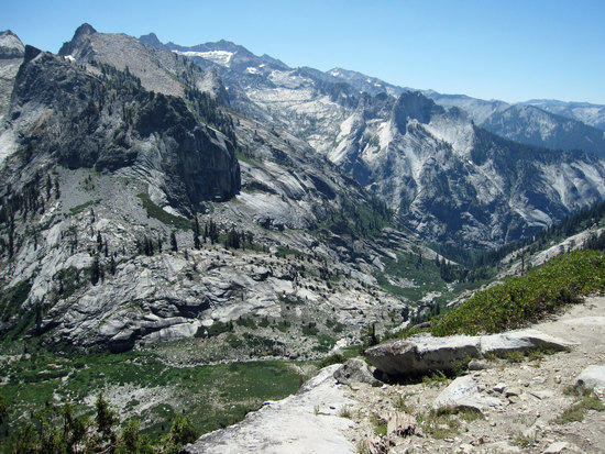
East Fork Clover Creek
Approximately 0.5 Miles East of the Junction at 8435 FT., past Cahoon Gap
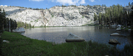
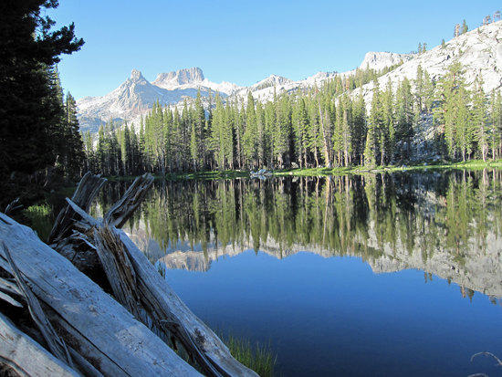
Twin Lakes Elevation 9419 FT. 4:29 PM
We where happy to make it to Twin Lakes, which was the first of two possible campsites we were considering. The lake was beautiful and the mosquitoes plentiful enough to match the large number of backpackers who were staying here. This was clearly a very popular destination given that it was about 8 miles in from the trail head. There were people swimming in the lake and campsites a bit too close together for comfort. The people were friendly enough, but we wanted something different. So after take a snack break with head nets on, we decided to push on over Silliman Pass and shoot for Ranger Lake on the other side.
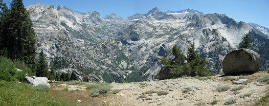
Silliman Pass Elevation 10,180 FT.
A steady climb upward that quickly gave us a nice view looking down upon Twin Lakes. Silliman Pass was a bit windy, a relatively flat and sandy/gravel like area without water. Wonderful views and it marked the beginning of our last leg of the trip for the day. A nice steady downhill trail was welcome at this point.
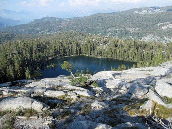
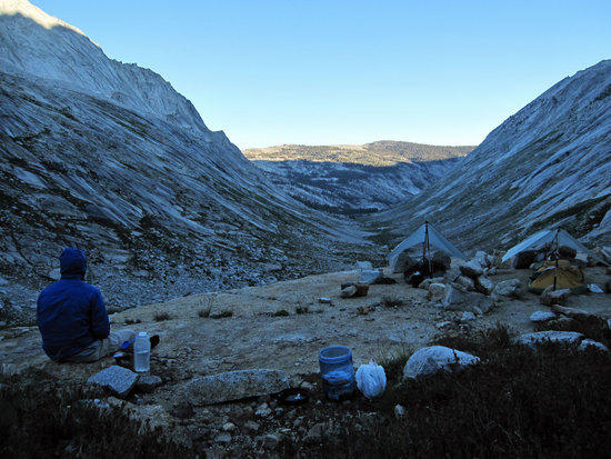
Ranger Lake Elevation 9193 FT.
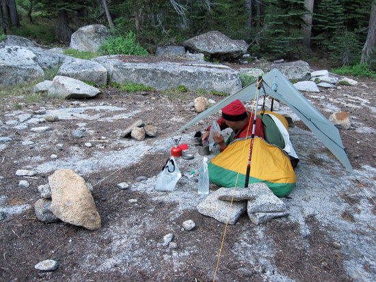
Jeremy's Dinner Time at Ranger Lake after 9.5 Miles on the trail.
Upon reaching Ranger Lake at about 6:20pm, we were happy to find that there were was only one other group of three guys here to share the whole lake with and that the established campsites were a good ways from each other to provide privacy and quiet. There where bear boxes for food storage, but the one near us had been crushed by a fallen tree. No worries as we would not see any bears on this trip.
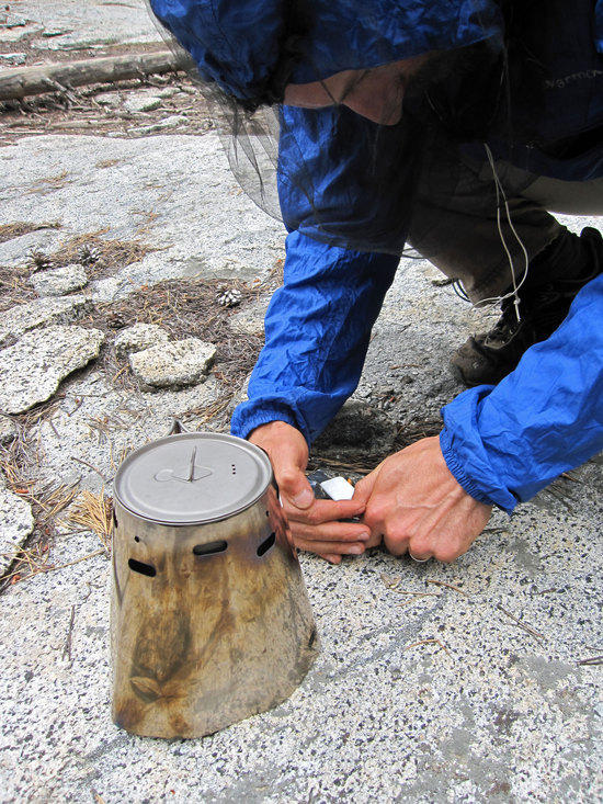
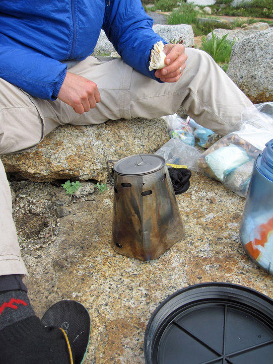
Note: Jeremy's cook setup is a Tri-Ti Caldera cone using esbit fuel tablets and the gram cracker esbit stove. Jeremy uses boil in a bag meals and manages to use less than 1 tablet for boiling his water for his meal and hot tea. Jeremy's only hot meal of the day is in the evening. Jeremy is sporting a BPL heatnet at 0.33 oz.

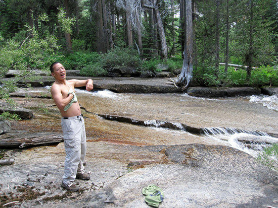
Asian Tourist and Photographer, uh…like no one has ever seen one of these before.
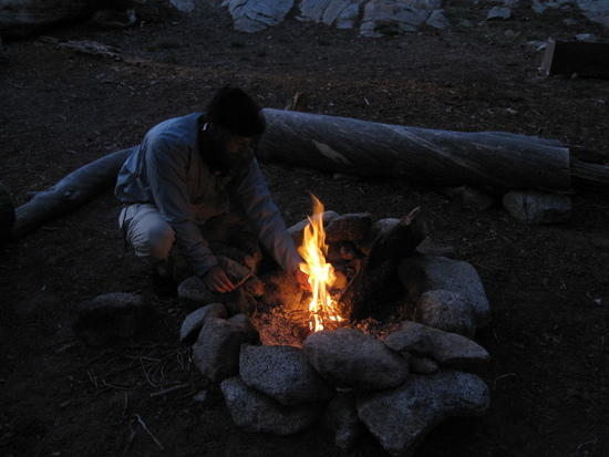
A Little Fire to Pass the Time
There was plenty of dry, fallen, and rotten trees around to use for firewood. Using my BPL firesteel and petroleum jelly coated tinder tab made it very easy to start a fire. This would be the only campfire we would have on this trip.
Note: In the Upper Right Hand Corner of the photo, you can see part of the crushed bear box at this site.
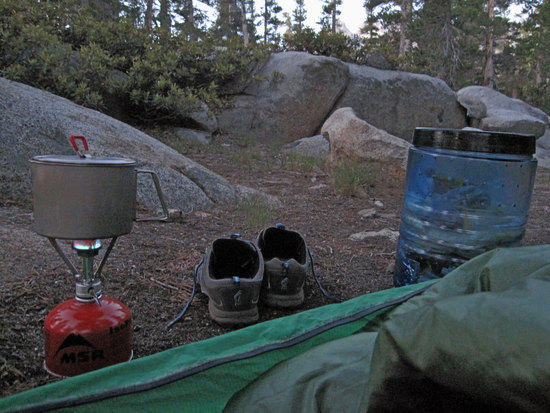
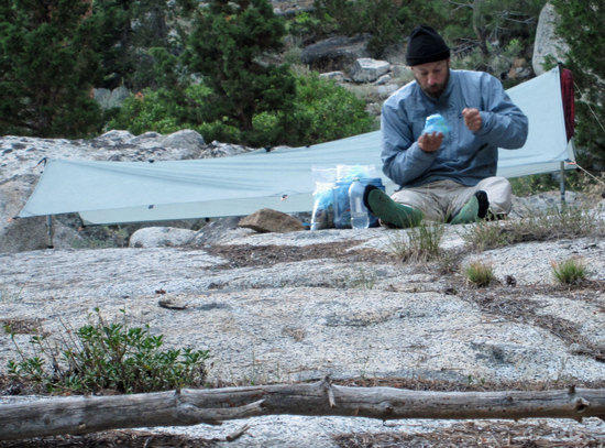
Morning View From the Bivy 5:48 AM
Recently I have taken to having breakfast in bed. I leave my MSR Titan Kettle full of water and have it sitting next to my MSR Pocket Rocket canister stove. Waking up from my MLD Soul Side Zip eVent Bivy, I roll out and slip on my Innov-8 295 trail runners, quickly retrieve my bear vault, and slide back into my warm Jacks R Better Sierra Sniveler quilt. Lighting up my stove, I can lay back and enjoy the cool silence of the morning air. Later, I can simply pull my pack from under legs in the bivy (or from under the bivy if it is not mud/wet) and kneel inside of my bivy and start packing my gear away into my Jam2 pack, rolling up the bivy as one of the last things to stuff into my pack. I find that this keeps my gear pretty clean from the dirt and mud of the trips.
Tricks with Sticks
Laying out in the open without any bushes or trees to tie my bivy head loop to, I simply cross my hiking poles and use rocks to secure them in the upright position. I find that having the bivy head area tied off keeps the bug netting off my face while I sleep.
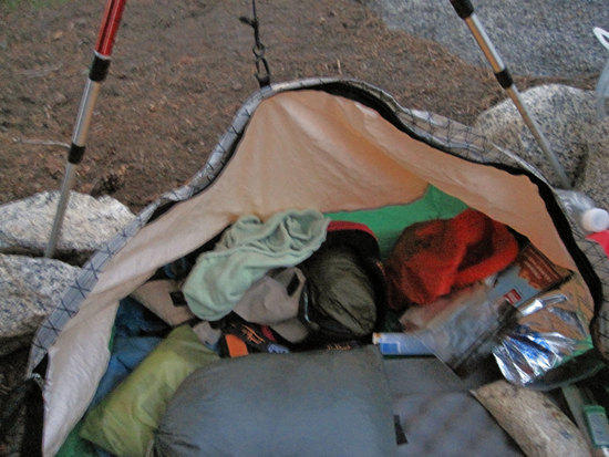
Everything Except the Kitchen Sink, A View Inside My Bivy.
At the top of my bivy, above my head, I have all of my gear from my pack stored securely. (I hate to misplace things…guess I am pretty anal). Left to Right: Blue Bag of extra clothing: BPL Merino Wool Thermal Top & Bottoms. Green Sea to Summit Bag Medical/Repair Kit with BPL Head Net. Above this is my green auto synthetic car shammy/wash cloth, which is wrapped around my Sawyer inline water filter. (Protecting it from being damaged by freezing). Under the wash cloth is my Sunday Afternoon Sun Hat. Under that is the Orange Strap of my Petzel XP2 Headlight. Right of the Green towel is my red Intergal Designs Primlid synthetic insulated hat, which is so warm that it is only for around camp and sleeping. (The BPL Hoody has replaced my need for a fleece beanie hat to wear on the trail when it gets cool). Inside the Red beanie is my windshirt, gloves, and rain mitts. The Orange Sea to Summit Bag holds my daily use odds and ends: BPL razor blade, fire starting kit, compass, tooth brush and tooth powder (baking soda & salt), toilet paper, hand sanitizer, triptease cord, daily medication (Alieve, Asprin, Salt Stick Electrolyte pills, asthma rescue inhaler), extra camera batteries, and soap. Everything else is food stuff for breakfast and snacks to hold me over til lunch. Gray bag in the middle is my MLD Poncho Tarp, Rain Chaps, and 1 oz emergency rain poncho- all of which I have used as a pillow.
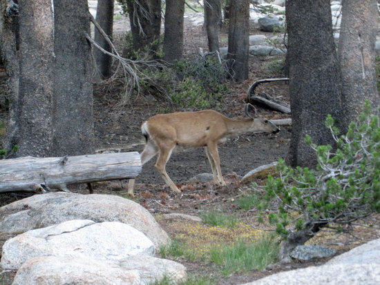
Things that Might Eat Jeremy in the Middle of the Night
That night Jeremy kept hearing some wrestling noises in the brush around the camp in the middle of the night. Things that prey on your imagination and makes you wonder if you look like a bear burrito while in your bivy. Turns out that on a small hill above our campsite, we had a mother dear and her little ones nibbling around out site. Snapped this shot of momma taking a stroll through our site.
Ranger Lake Morning
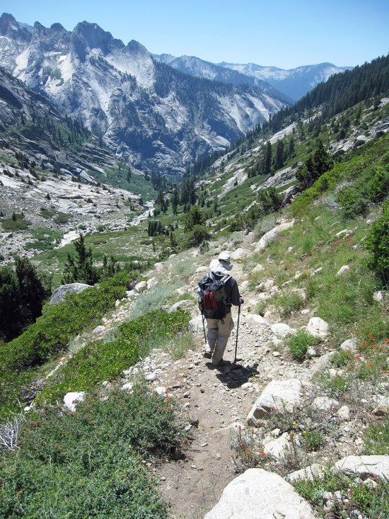
Section of Trail East of Ball Dome and North East of junction elevation 8880 FT.
We hit the trail at 8:08 AM, giving ourselves a bit of a leisurely start. With cool morning air and the sun blocked by the trees, it was easy going. Very early on the trail we came across a number of Boy Scouts who had camped at Lost Lake the night before. We chuckled a bit at one Scout who looked a bit like a gypsy with so many thinks hanging on the outside of his pack…including a quart sized pot.

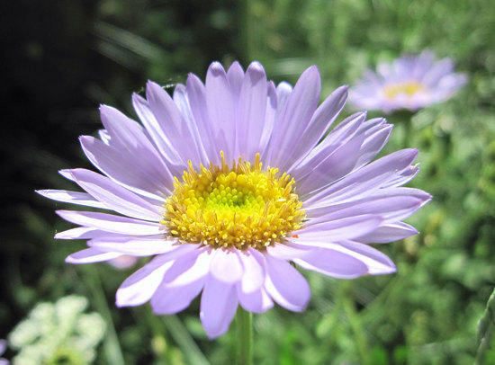
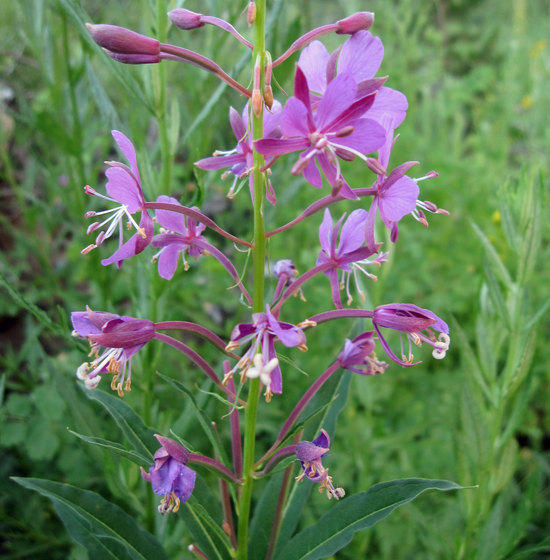
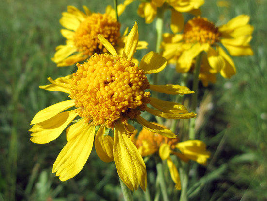
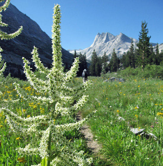
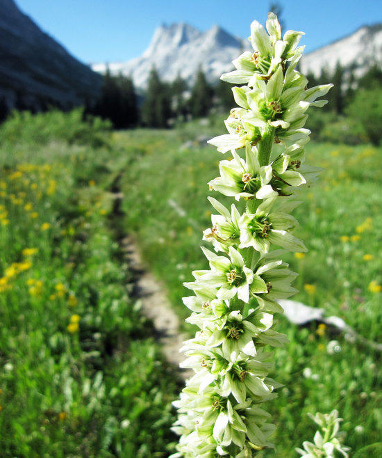
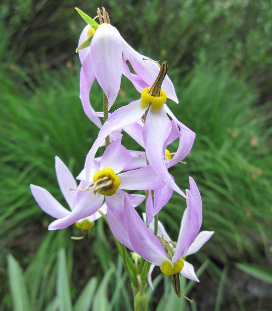
Leopard Lilly?

Alpine Aster or Wandering Daisy?
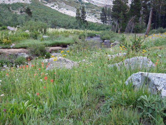
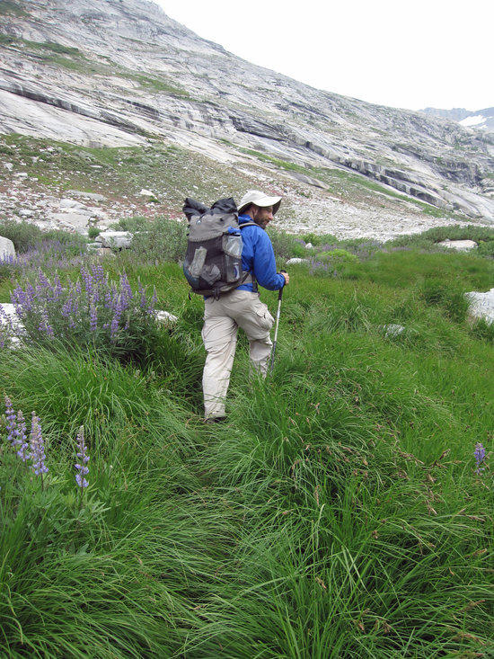
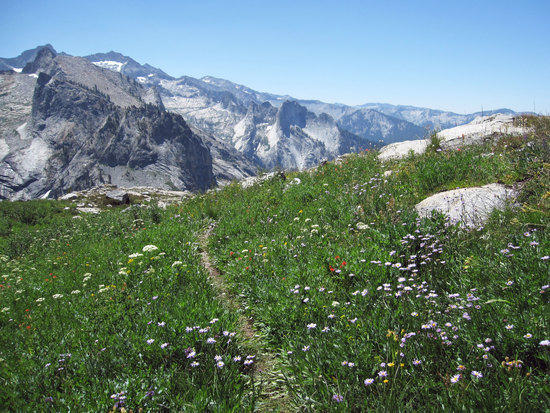
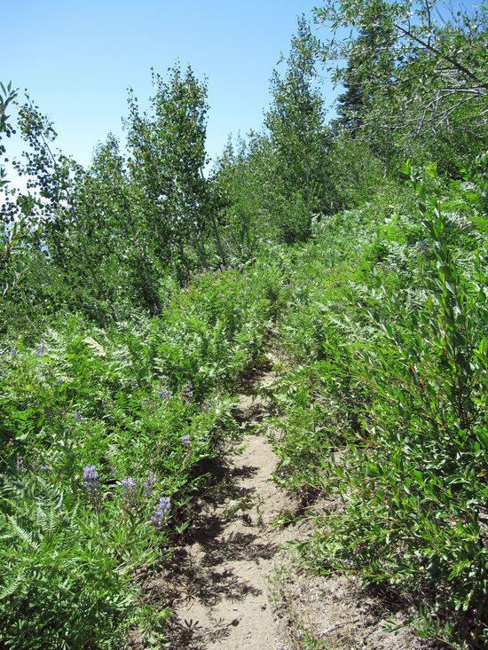
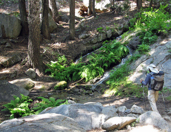
Wet , Lush, and Colorful
The early parts of this trail in the morning were damp to slightly muddy. We were quite surprised at how many flowers were blooming at this time of the year.
On the trail to Belle Canyon

Jeremy Taking Time at the Junction to Change His Socks
Location: Belle Canyon Intersection at 8270 FT.In a new twist on this trip to prevent blisters, Jeremy was wearing Dirty Girl Gators and was rotating his socks from time to time in the hope that different socks would wear/rub his feet a little bit different due to the shape and cut of the socks. Apparently, it worked as Jeremy went through a whole trip without any blisters, which was a first for me to witness. His shoes might have done something it too. Upon returning home, he promptly ordered two additional pairs of these shoes.
Where There is Smoke, There is Fire…decisions to be made, escape route planned.
Having turned North East at the Junction, we headed steadily down into Belle Canyon. About half way through the canyon we started to smell smoke. Looking behind us and back towards Twin Peaks and Silliman Pass, what was once clear blue skies was now shrouded in a brownish white haze of smoke. Before us was a thicker haze with no discernible plume of dark smoke to tell us the source of the fire or what direction it was traveling. While Jeremy was working on finding out position on the topo map, I when off trail a short distance to the top of a hill to try to get a better view of what might lay ahead of us. This photo was taken at that spot, which offered little sense of what we might face.
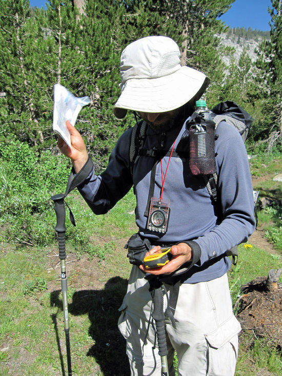
Jeremy Checks for Our Position
Prior to this shot, as we continued deeper down into the canyon we came across a backpacking couple who had decided to turn around and returned the way we had just come out of concern for the smoke and fire. Like us, they were uncertain of where the fire was. Jeremy and I had decided to press on a bit further to see if we could get a better view of the situation, not wanting to abandon our planned trip. Part in humor, part in seriousness, upon bidding them fair well, we gave them our names…just in case.
Pressing on into the Uncertain Haze
As Jeremy and I continued down the trail, we were frustrated that we could not see clearly around the corner of a ridge East of Crowely Canyon and West of Box Canyon on the other side into Sugarloaf Valley. Our conversation was one of wanting to continue on, but asking each other questions to check for sanity and not suffering from "target fixation" at having to get to our planned campsite. My concern was turning East into Sugarloaf Valley and walking into a fire with no way out other than back out to out race a fire. We even checked the map for defensive creeks as natural firebreaks along the way. So with measured levels of hope we continued on, hoping to get a clearing view of the what lay before us as we approached the 7890 FT Elevation intersection at Commanche Meadows.
Straight Shot Through the Woods and Into the Clear
Having turned the bend at the 7890 FT Junction at Commanche Meadow, we turned North East along Sugarloaf Creek. The skies were hazy with smoke, but without any further indication of where the fire was and which way the smoke was blowing we decided to push steady on at a quick pace. The forest trees soon covered our view of the horizon. So sniffing the air for smoke and looking for any signs of smoke drifting through the trees, we continued on committed to shooting through this section to the other side to Roaring River Ranger Station.
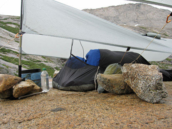
Tony's MLD eVent Soul Side Zip Bivy.
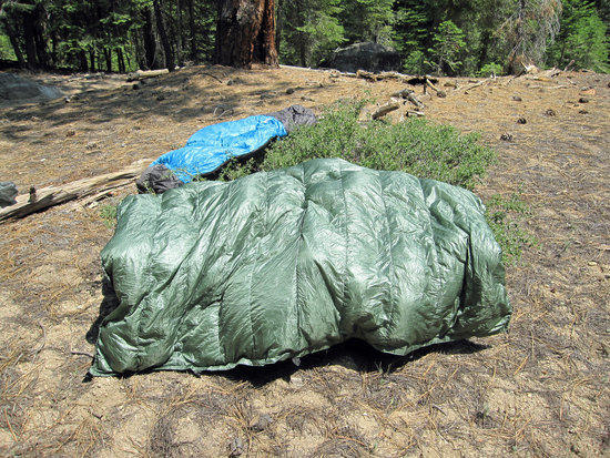
Drying in the Sun at Lunch Time. Tony's Green Jacks R Better Sierra Sniveler 25F-30F Quilt. Jeremy's Blue GoLite 25F-30F Quilt.
Southwest of Sugarloaf Peak (7995 FT) and just before where a creek from Sugarloaf Meadow cuts across the trail and connects with Sugarloaf Creek, we stopped for lunch. At this point, we were pretty confident that we were safe and we had a feeling that the fire was blowing in from the Northwest from outside the park, and we decided to break for lunch. We both took this time to dry out our gear, which was a little damp from the morning dew/condensation from the night before.
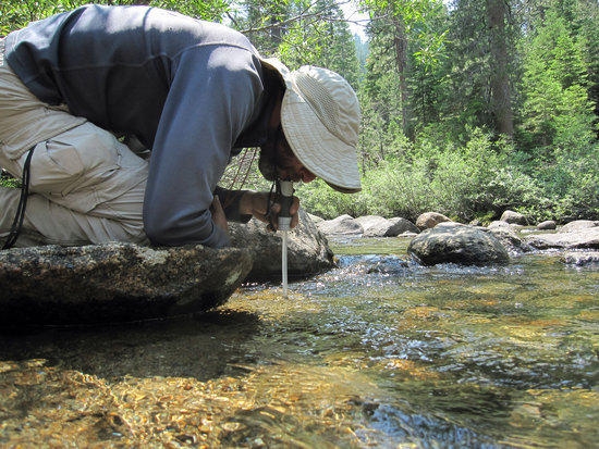
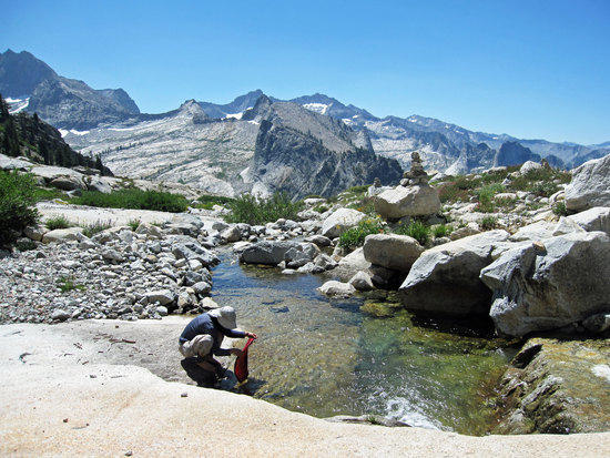
Jeremy Takes a Drink with His Aqua Mira Frontier Pro Filter.
A few yards away from where we had lunch was this creek, which I had crossed in my trial runners. Was nice to have my feet cooled off. Took time here to tank up on water and to wash up a bit.

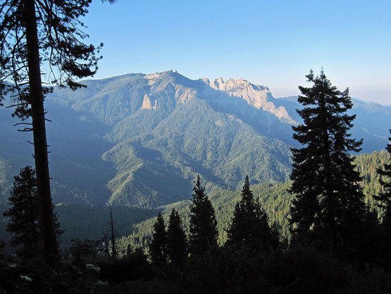
Homer Mountain??

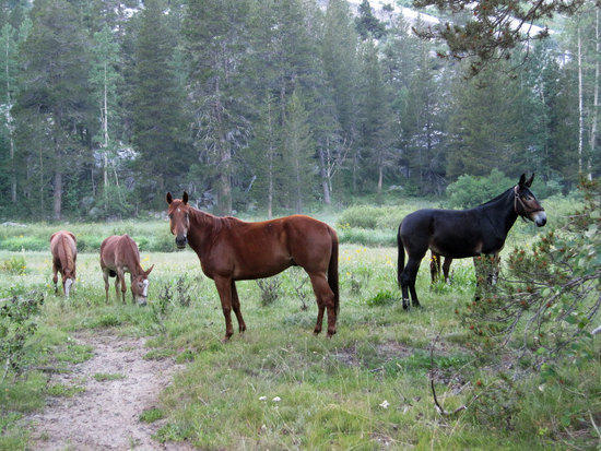
Ranger Cindy and Her Mule Train Leaving Roaring River Station.
We had met three older hikers on the trail a mile or so prior to meeting the ranger. They were singing her praises as she generously offered to haul all their packs by mule and drop them off at their next destination. This allowed them to essentially day hike light and fast this day. She was also able to give us some insight on where a good campsite might be in Deadman Canyon that might have less mosquitoes.
Another Gate

Roaring River Comes into View

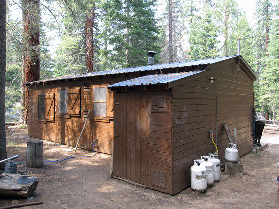
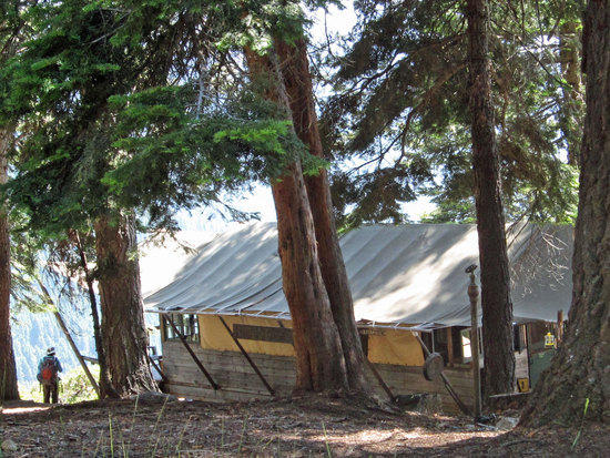
Roaring River Ranger Station
Elevation 7400 FT.Not a Bad Place to Take a Break.

Home Made Sawyer Gravity Filter at Work.
I took my 4 Liter Platypus Water Tank down to the River where there was a bridge crossing over and collected some water. Returning to the Ranger Station, I setup my inline gravity filter for both of us to reload on water for the next leg of our journey. In this case, the water tank is laid on its side with the Sawyer inline filter attached to the tank. The tubing from the filter is from my Platypus hydration system with bite value removed. The end where the bite piece was is directly attached to the bottom or output end of the Sawyer filter. The threaded end of the hydration tube I will screw onto my clean water bag.
Back of the Station.

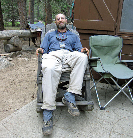
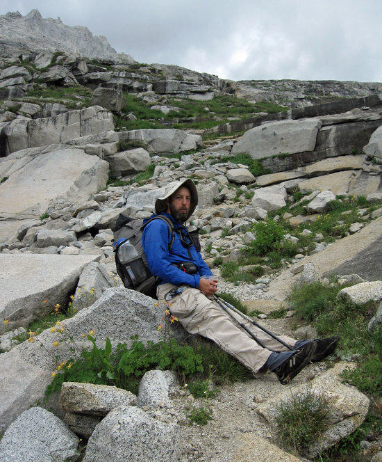
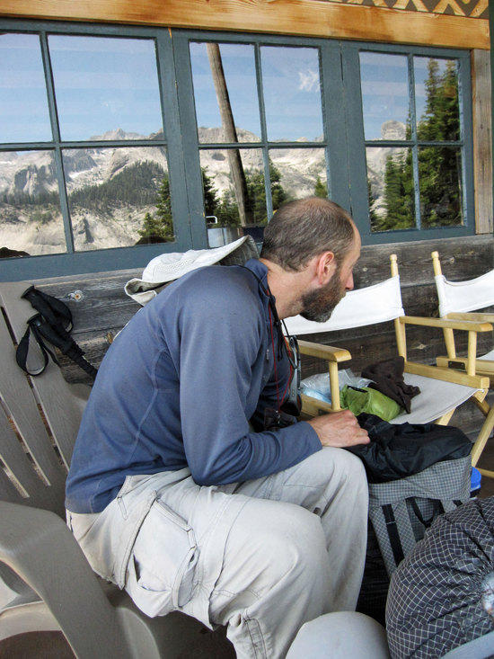
Jeremy Takes So Time to Relax.
Diving Deeper into Deadman Canyon
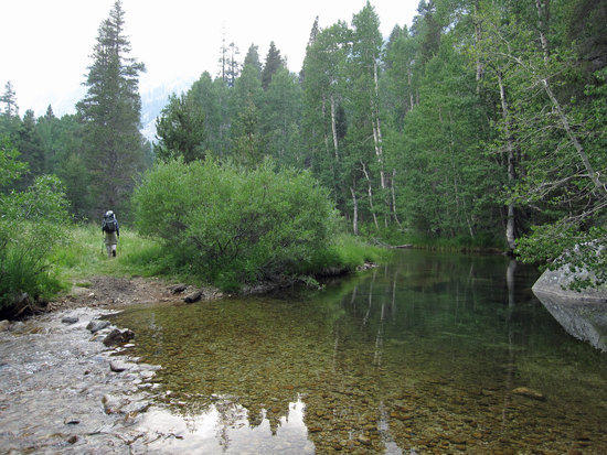
Crossing a River about 1.5 Miles South of Roaring River Ranger Station at 3:51 pm.Dark Skies Ahead.
The skies were getting darker and we wondered if we would get rained on.Pushing Steadily On.
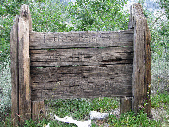
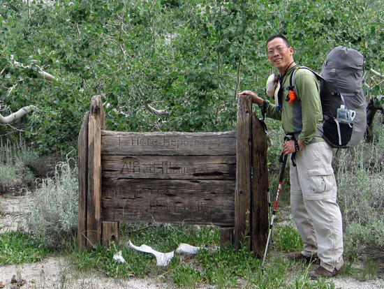
Deadman at Deadman Canyon
Per Wikipedi: “HERE REPOSES ALFRED MONIERE, SHEEPHERDER, MOUNTAIN MAN, 18—TO 1887.” Two common versions of this man’s story exist. In one, he is murdered, and in the other, he became ill and died while his partner went to Fresno for help.

Jeremy Getting Sorted out for Dinner. 5:05 pm
Camping Near/At Grave MeadowWe pushed on a bit and found a campsite along the trail, but found that is was fully occupied by a group of people who had been brought in by pack mules. They had full sized car camping tents and all the amenities. Just beyond their campsite were their pack animals in a meadow. Reluctantly, we hiked back North on the trail to find a granite shelf that overlooked the trail and was not too far from the river and made dinner.
Jeremy's Tri-Ti Caldera Cone & Esbit Stove.
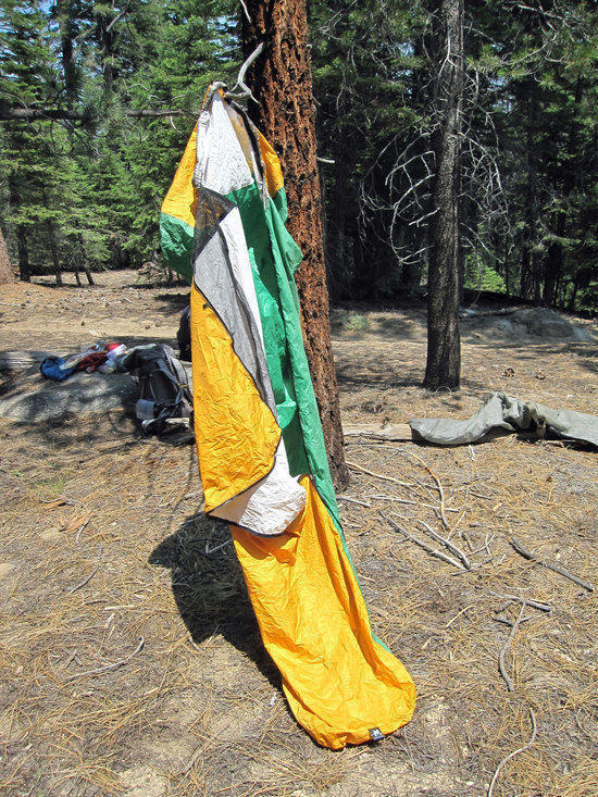
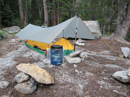
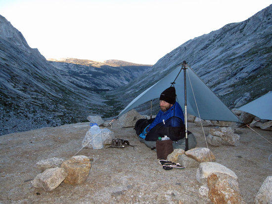
Home Sweet Home: MLD Poncho Tarp & Soul Side Zip Bivy
As we were finishing up dinner the gray skies started to drop a few scattered drops upon us. Working together calmly with a more than a little bit of urgency, we helped each other setup our shelters so we could toss our gear underneath them to keep it all dry in case the rain got worse. No stakes were used. We simply looped the ends of our guy lines around a large rock and then piled on additional rocks to hold them all securely down. Having been blasted on Mt. Whitney for 13 hours in a rain storm with this setup, I now love to pile on the rocks so I know that I won't have to wake up in the middle of a rainy night to secure my lines. Fortunately, we only had a few raindrops to deal with for a relatively short time.
Jeremy's MLD Poncho Tarp & Superlight Bivy.
Odd things is that despite the few drops that fell on us, we had to deal with mosquitoes. As a side note, I have to say that having two people to setup a tarp is so much easier than doing it yourself!
Tony Cleans Up for the Night after approximately 17.4 Miles.
Reflecting back on the day it really was an amazing contrast of challenges. Clear blue skies in the morning, smoke and a fire to worry about in the afternoon, and mosquitoes and rain drops in the evening.
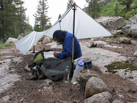
Jeremy Works on His Map Skills trying to see if he can find the ridges and peaks around us to triangulate our position on the map. Unfortunately, the maps we had were a bit too large in scale to get a very accurate read of where we were. Despite this, Jeremy was able to place our location with some certainty.
Morning of Day Three Over Looking Our Campsite 6:16 AM

Jeremy Having A Cold Breakfast Wearing Home Made Camp Sandals
Breakfast in Bed with Oatmeal
Note: Water tank is filled with dirty water to be filtered to reload my Platypus water bottles after I have drank my fill in the morning to rehydrate. Between breakfast and chugging down water, I like to tank up on 1.5 to 2.0 Liters of water to rehydrate before I hit the trail.
The Simplicity of the Poncho Tarp
The only complication of this setup is that the guylines need to be carefully wrapped up to prevent a tangled knot, which you don't want when you are facing an oncoming storm.
Pack Animals Along the Trail as We Head Out at 7:48 AM
Wet Pant Legs Among the Morning Dew
Morning Kisses the Mountains
Jeremy's Feet Gets a Morning Chill
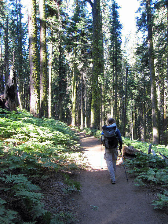
Getting Our Trail On
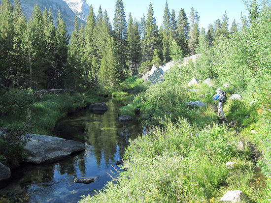
Carpet of Colors Along the Water's Edge


Late Flowers in the Year
Looking Back at Where We Came From
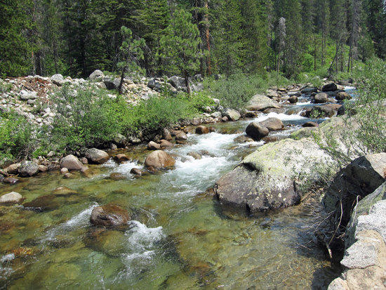
Black Granite & Thin Sheets of Water Rippling Over
It was about here that we met two backpackers who looked like they were in their mid twenties. They had spent the night at the far end of the canyon and had given us some suggestions of where we might want to camp and what the bugs were like up ahead. People you meet out in the back country have always been eager to share what they know and wear a wide happy grin that we share too. Knowing why we are out here and why we enjoy…no words need be exchanged. The grin upon all of our faces said it all.
Jeremy Catches Some Sun to Warm Him Up
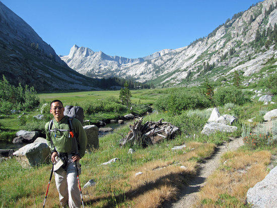
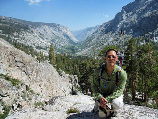
Tony at Ranger Meadow
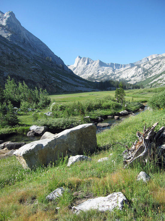
Can Not Get Enough of This
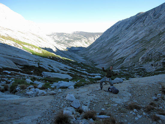
Jeremy in Deadman Canyon
Walking Through a Slice of What Heaven Should Look Like
Little Bit of Yellow

Glancing Behind Us
Coming Around the Bend

Beauty Beside the Trail
A Trail Cutting Across It
Jeremy Pulls Out His GPS, Preparing to go Off Trail
Bush Wacking to Find an Unmarked Use Trail to Big Bird Lake

Jeremy Takes a Hop, Skip, and a Jump
Shooting Up the Drainage from the Lake
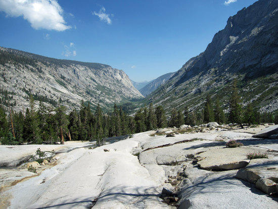
Looking North Up Deadman Canyon
We were gaining elevation quickly and the views were only getting better and better. The sun was out, but is was not hot at all. From time to time, a cool breeze would hit us and provide a bit of welcome relief from the sweat on us.
Jeremy Taking a Snack Break Before Making a Final Push to the Top
Hard Climb to the Top
The Pay Off
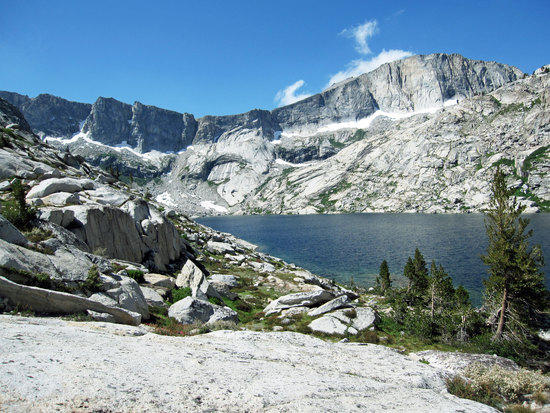
Taking A Look Back as We Approach Big Bird Lake

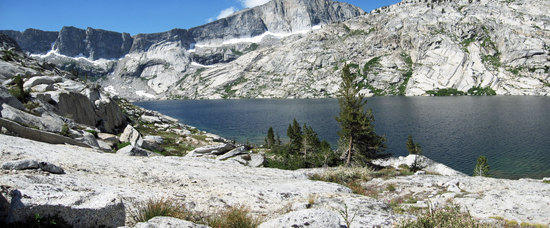
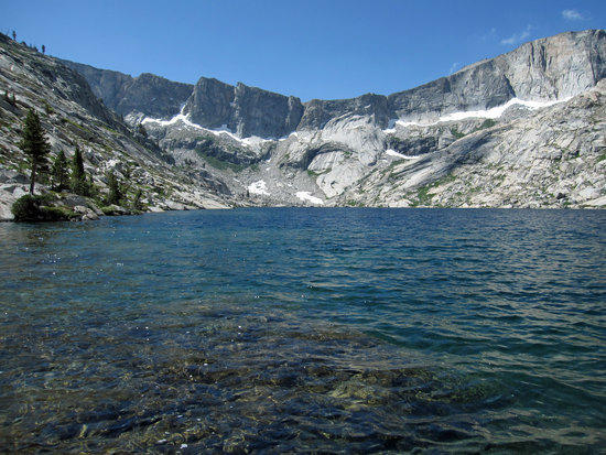
Big Bird Lake
Misty Sunshine Falls From My Eyes,
As the Warmth of the Sun Kisses my Face,
Gentle cool pine breeze whispers to me through the trees,
Washing over my body,
Cold from the icy waters,
I lay upon the warm granite,
And I imagine that you are with me.And now that you are gone,
The memory of your voice echoing in the trees,
I continue on the trail with my thoughts of you,
Sharing the adventure for two,
When only one of us remains.Jeremy Braves the Icy Waters
Tony Drying Off in the Pleasant Afternoon Sun
Descending Down
Having enjoyed the whole lake to ourselves, take a bit of a bath, and have a leisurely lunch, we said farewell and started to work our way down a different way then we had come up.
Cutting Across to Intersect the Trail
On the other side of the Canyon, where the green meadow meets the granite talus, was where the trail was.
Working Through the Maze of Stream and Brush, Mindful of Possible Bears
View Down South from the Middle
The Patch of Green at the Far End of the Canyon that was about a Third of the Way was our destination based on the two guys we had met earlier in the day had recommended.
Dark Skies Chasing the Blue Away
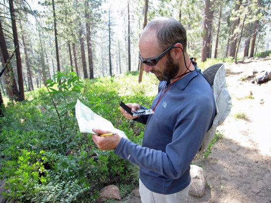
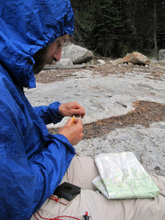
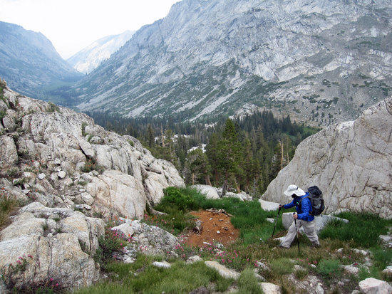
Jeremy Working the Compass to Find Position on the Trail
After a prior trip in Yosemite where he ran into a snow covered trail, Jeremy was eager to use this trip to brush up on his navigation skills.
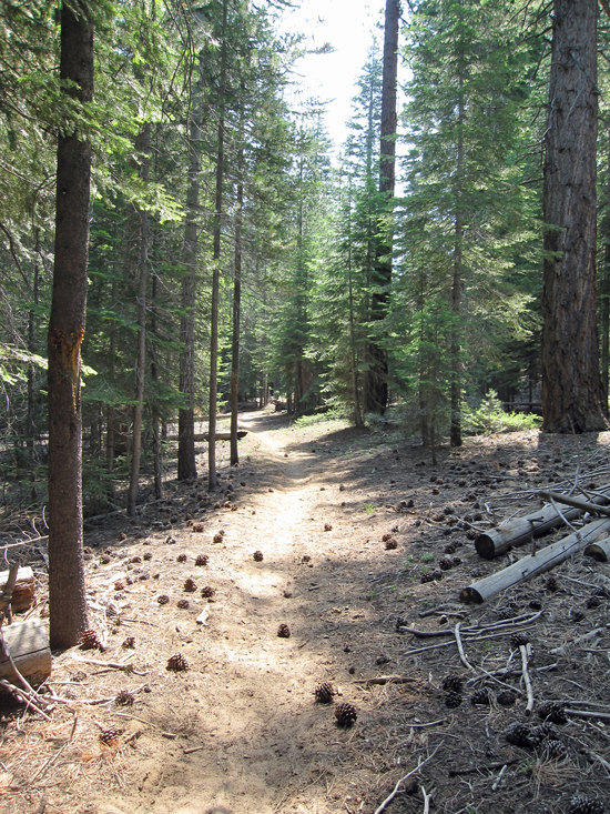
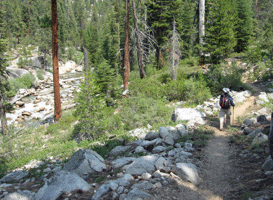
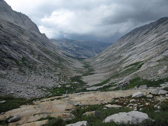
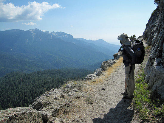
The Trail Gets Rocky and Barren
Cutting Up the Eastern Side of the Canyon

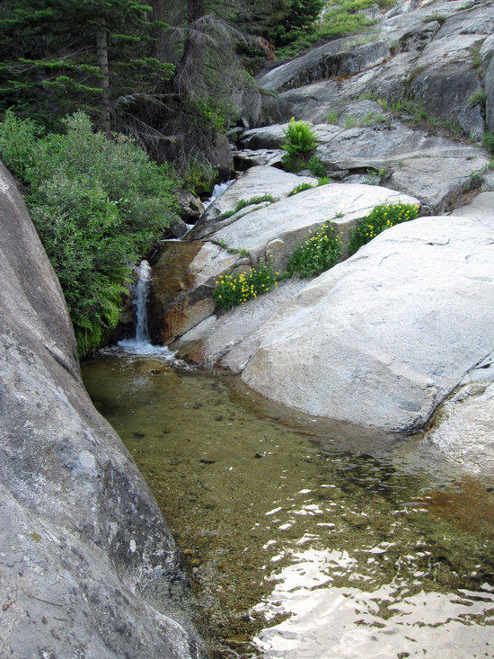
Array of Colors
Admiring the Water, Rock, and Patch of Snow
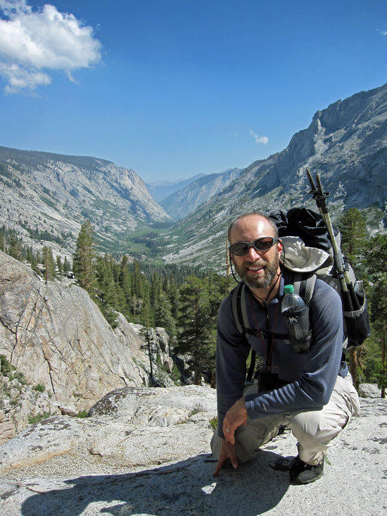
Jeremy Surveys the Way Up, Both of Us Wondering How Far We Might Make it Up the Canyon and Where a Campsite Might Be
Lush Color in Unexpected Places
The trail here was lush and a little muddy from the few gurgling veins of water that made its way across the rocks and green grass.

Jeremy Kicking Back to Take in the View During a Snack Break
By this time, the skies had darkened and a cool breeze had kicked up. Like some prior trips we had taken, we were a bit amazed at how the weather could change so much in just a few hours. Sunbathing to facing a few blown droplets of rain with dark threatening skies in one afternoon.
Scanning for Possible Campsites
Urgent Reason to Move with a Purpose
Looking Back North Up the Canyon, We Could See Rain Coming Down from the Dark Clouds Hovering Above. We pushed a little further and seeing nothing promising ahead, we back tracked down to the brownish granite shelf you see below to setup our campsite.
Teamwork Saves the Day
With the weather certain to roll in on us in just a matter of 20 minutes or less, the sound of thunder crackling off in the distance, we worked steadily and quickly to setup Jeremy's shelter first. In part, because my MLD bivy had an eVent top, worse case, I would be okay exposed to the rain. After Jeremy's poncho tarp was setup, I worked nervously quick to get my guy lines attached to my poncho tarp and dealt with the occasional gust of wind that would toss my poncho tarp around. With Jeremy's help, my shelter was put up just in time as the droplets of rain started to patter against the silnylon.
Note: Two things: left of Jeremy and a few yards down was the edge of the shelf that led to a granite slide down. So it was important to make sure things like our bear vaults did not roll away. The one draw back to a poncho tarp is that when it is converted into a tarp, you really don't have any rain gear. This is partially solved with an inexpensive 1 oz disposable rain poncho, which is good enough for moving around camp, but not for hiking in.
Jeremy in his Bivy and on His Pad, Concerned about Lightening
View From My Bivy in the Drizzling Rain
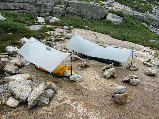
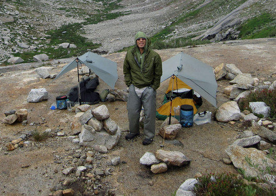
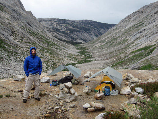
Twin Tarps in the Canyon
Elevation 10,000 FT and approximately 1 mile below Elizabeth Pass.

Tarp Setup on the Rocks
Our Source of Drinking Water Close By
Building the Great Wall of Wong
Tony suffers from the "Chihuahua" gene and therefore can not seem to relax by sitting around and just "being". So he passes his time by getting in touch with his roots by building rock walls and preparing for the Mongol invasion of bad weather. After dinner, Tony walked on the trail above our campsite and found a stretch of smooth granite with only had a few rocks set out on it to mark the trail. Sensing the need to do something, he set about gather rocks to better line both sides of the trail with stones til the sun set. The only cure for Tony's condition is to hike long distances until exhausted or when he starts to do the "Wong Wobble" on the trail. Apparently, this is one of Jeremy's goals in planning these trips…to induce the Wong Wobble.
Dinner Time After the Rains Let Up
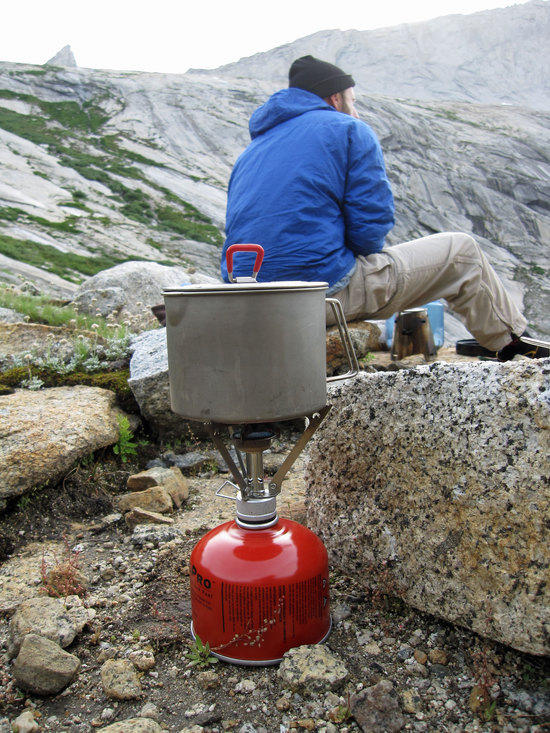
Boiling Water for Boil in a Freezer Bag Meals
MSR Titan Kettle & Pocket Rocket
6:41PM Break in the Weather, The Sun Returns
From Rain to Shine all in an Afternoon
7.1 Miles Traveled Today6:32 AM Forth Day, Jeremy stirs from his Bivy
Chilly Morning in the Shadow of the Canyon
It was not cold enough to freeze the water in our water bottles, but it was cold enough that I wore my rain chaps to give me a little bit of warmth to my legs. Breaking down camp provided plenty of exercise to warm up, scattering the mountain of rocks that we had gathered up to hold down our shelters and for building a wind break at the foot end of our tarps. Fortunately, the weather had been kind to us and gave us a night without rain and without howling winds.
Area Just Above our Campsite
Tony's Morning Happy Dance

No Man is Complete without Rain Chaps
Next time I buy one of these from Ron at MLD, I think that I might go for something in black with titanium studs or sequins.
Breaking of the Sun into the Canyon
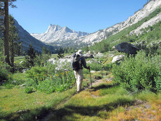
Steadily Moving Forward, Gaining Lots of Elevation
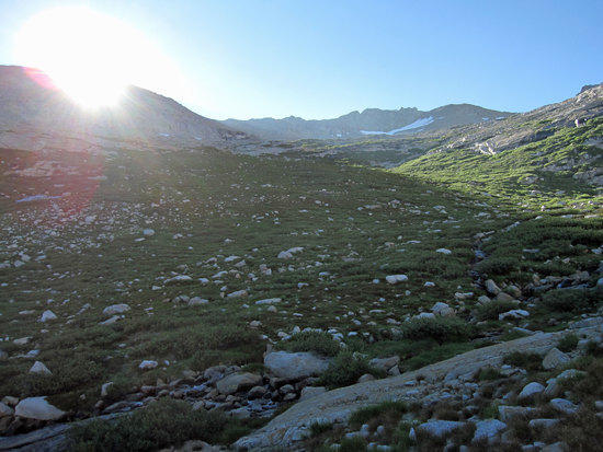
Morning Glory
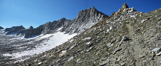
A Hard, Rocky Trail
The steady tapping of the sound of our hiking poles striking granite sounded the beat of our steady march onward and upward. Taking momentary breaks to catch my breath and to take in the views. The sun shining upon us, we stripped off our layers of clothing and continued on, glancing over our shoulder from time to time to look out and down upon the Canyon we had marveled at the day before.
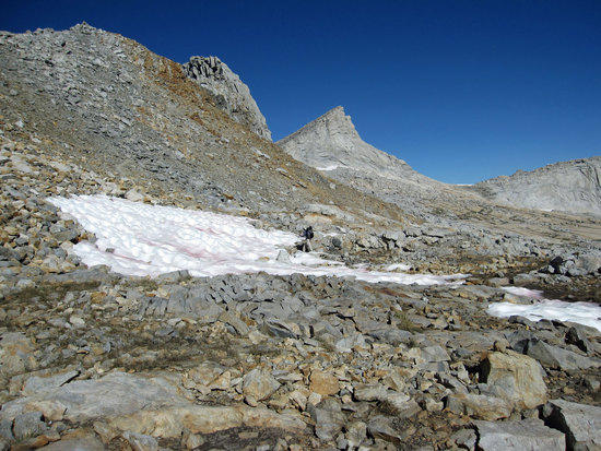
Remnants of Winter Glaciers in August
Jeremy Starts Across a Patch of Ice
The Fine Details of Ice & Rock
There were sections of the trial that were covered in clear sheets of glass like ice, which made for something unexpectedly wonderful to see upon the trail.

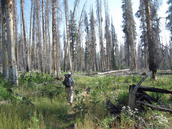
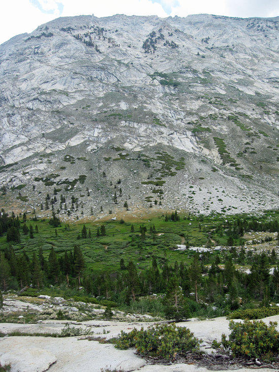
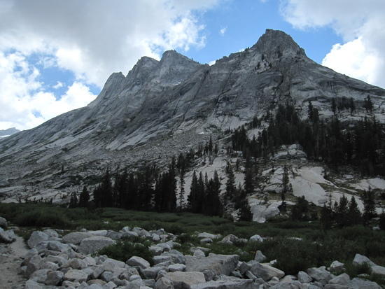
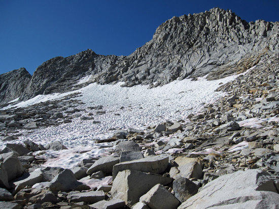
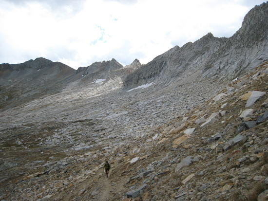
Barren Trailscape


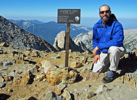
Tony & Jeremy at Elizabeth Pass
Entering Sequoia National Park, Leaving Kings Canyon National Park
Elevation 11,370
9:22 AMView of the Pass
After taking a snack and restroom break, we started the steep decent downward. Near the end of our trip yesterday, we had met a woman in sandals who had climbed up the pass and dropped down into the canyon, happy that her pack was so light after about a week on the trail. It was pretty impressive that has had come up the steep part of the trail, which we were now descending.

South Western View
Enjoying a nice downhill stroll
Jeremy with the Table Lands and Moose Lake Behind Him
When we were at Big Bird Lake, we had toyed with the idea of cutting across the Table Lands and to rejoin the trail at Pear Lake to get some off trail navigation time, but decided to save it for another time.

Coming into View
Lunch Time Oasis
Taking an early lunch, we had time to wash up a bit and tank up on water while enjoying an amazing view.
Leaving it all behind
The Hills are Alive the Colors of Spring
We were pleasantly surprised by all of the wild flowers in bloom on this trip. We surmised that due to the heavy snowfall this year, the snow melt took longer and gave us these flowers so later in the season.
Tamarack Lake Lies Up There
Spectacular Decent & View of the Great Western Divide
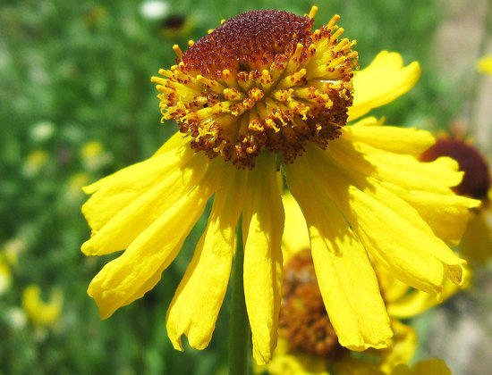
Field of Color

Bigelow's Sneezeweed
Intersection at 8060 FT, 3.1 miles from Elizabeth Pass
Here the trail branches off 1.1 Miles South to join the High Sierra Trail and towards the beautiful Hamilton Lakes area. 1.8 miles to the east lies Tamarack Lake. And for us, 2.1 miles away lies Bearpaw Meadow. Was nice to splash cold water on my face after being exposed to the afternoon sun for a while.
Steep, Dusty, and Green
I was getting tired by this time, just plugging away with my hiking poles in hand, trying to keep up with Jeremy, and dripping sweat the whole time.

Taking in the View While Taking a Snack, Enjoying a Pleasant Breeze
A Short Cut of Sorts
We chose to take this 2.1 mile route for two reasons: 1. It was shorter by 0.6 miles vs. descending down south to the High Sierra Trail and turning West. 2. We had not been on this section before and we had done the High Sierra trail together three years ago. Down side was this trail was more grown over and more rugged with dips and climbs.
Dropping Down onto the High Sierra Trail West of the Bearpaw Meadow
Kicking Back at Bearpaw Meadow High Sierra Camp
It was a little strange to be back to place that Jeremy and I had previously been to before and it brought up good memories of our HST trip to Mt. Whitney three years ago. We were on the home stretch as we knew what to expect from here on out.
High Sierra Camp
Note: There is a kitchen here that serves the guest staying at the tent cabins here. Not sure if they will sell food to non guest. There is a water spigot here, but the water must be treated/filtered. We used my gravity filter to tank up a bit here.
Crossing Buck Creek

Pleasantly Shaded Trail
Jeremy Looking Out Over a Familiar Trail

Last Look Back

An Eroded Trail

Mehrten Campsite, first campsite in from Crescent Meadow Trail Head
4:45 PM Tony Dead Dead Tired after 12.2 Miles
At 5.5 miles away from Bearpaw Meadow High Sierra Camp, we had an option for traveling North West up steep section of trail called the Seven Mile Hill Trail, which would have taken us to Mehrten Meadow. We mercifully opted not to travel the 2.7 miles/1250Ft Elevation gain to Mehrten Meadow. There were also concerns that we might run into swarms of mosquitoes higher up.Steep Climb Down to the Water
The campsites here are essentially stacked on a steep ridge with flat spots decently spaced between each other. Though Mehrten Creek runs a short distance East of the sites, it is a steep climb. Nothing that I would want to do in the dark. The was a pretty large group of Boy Scouts below us, but we hardly saw them. Wood was scarce and the area picked clean by heavy use, due to the close proximity to the trail head.
Re hydrated beans, Parmesan Cheese, & Taco Bell Hot Sauce
Getting better with my food…only a handful of trail mix and one or two Cliff bars for extra food at the end of the trip.
Heading out at 6:56 AM from our campsite
Views along the trail
Cool Morning Trail
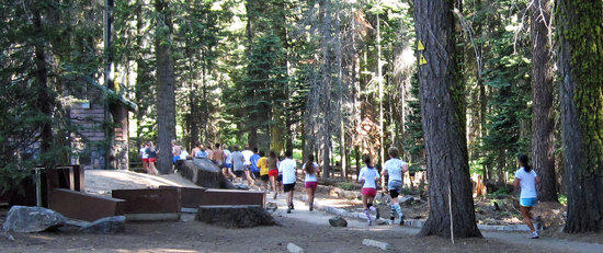
Racing to the End, Entering Crescent Meadow
As we entered the edge of Crescent Meadow, we were greeted by quite a few trail runners. We knew that we were back in civilization and that our trip was over.

5.3 Miles to the End 9:12 AM
Waiting for the Free Shuttle Bus to take us to Lodgepole
High School Age Trail Runners
Note: Restrooms available here
One of Two Short Shuttle Rides Back
On the second shuttle ride we had met another backpacker who was just starting out. He was a traditional backpacker and just looking at each other on the shuttle, we recognized each other as fellow backpackers. He shared with us that last year his mother had passed away and in honoring her he had hiked the JMT. He shared with us his love of the trail and the touching story of his JMT trip carrying heavy with 2 full sized bear vaults. Always say that some of the best people you meet are fellow back country backpackers. The common bond of knowing why we are out there instantly shared, welcomed, and recognized.
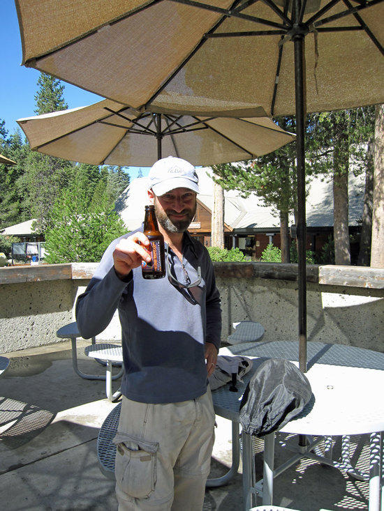
Jeremy's Way to End Every Trip
Back at Lodgepole Visitor's Center/Store
Note: If you would be interested in seeing the whole High Sierra Trail, which ends at Mt. Whitney, please see the hyper link in the list below.
Other photo essays by Tony:
BPLers GGG: Henry Coe State Park, CA.
BPLer's GGG: Point Reyes, CA. 2nd Annual Trip
BPLer's GGG: San Francisco Bay Area, CA.; Mt. Diablo
BPLer's GGG: Yosemite: Hetch Hetchy Resevior to Rancheria Falls
High Sierra trail to Mt. Whitney
Yosemite: Glacier Point to Red Peak Pass to Lake Merced
Yosemite in Winter: Crocker Point & Dewey Point
Yosemite: Lake Vernon & Hetch Hetchy Reservoir
Photo Essay by Linda Vassallo: Mt Whitney Summit Hike: A photo essay
Trip Report & Article by Jeremy Pendrey: Hiking The Diablo Trail: A Conservation Success Story
Oct 4, 2010 at 12:48 pm #1651355Nice TR and pics. You always do a nice job putting these together. I am looking forward to the next installment.
Oct 4, 2010 at 3:38 pm #1651424Nice pictures Tony–keep them comin–I thought you were on restriction this summer Tony? Jeremy you need to fix that Sunny Days Hat-too floppy.
Oct 10, 2010 at 6:17 am #1653069No Man is Complete without Rain Chaps
Next time I buy one of these from Ron at MLD, I think that I might go for something in black with titanium studs or sequins.
This is classic Tony. I'm predicting an epic case of chafe if you plan on doing the 'Morning Happy Dance' in studded rain chaps, between the 'Wong Wobble' and the 'Morning Happy Dance' you better pack some Body Glide.
Loved the trip report Tony!
Oct 10, 2010 at 11:42 am #1653127Another great trip report of a beautiful hike. Thank you for sharing Tony.
Oct 10, 2010 at 7:19 pm #1653226Tony: Thanks for posting all the pics. This was one of my favorite trips. Deadman Canyon was beautiful, and the solitude in such an amazing place was also great. Next time we'll hit up Cloud Canyon too.
-Jeremy.Oct 10, 2010 at 7:20 pm #1653227Note to self….I must go there. Great trip report guys!
Oct 10, 2010 at 9:06 pm #1653272Nice trip report (as usual). I passed that way last summer doing a loop from Kings Canyon to Mineral King and back. I think we camped on the same rock ledge in Deadman Canyon that you did! (And that's where some mice ate the whole front half of my baseball cap in the middle of the night.)
Oct 11, 2010 at 6:08 am #1653329Great Trip Report! Thanks!
Oct 11, 2010 at 1:41 pm #1653453Eugene,
Actually, I need to credit you on this photo essay. I have enjoyed your trip reports so much that you inspired me to write a lot more about the trip vs. just putting captions under each photo.
The more of these that I do, I think that I am suffering from a case of verbal and visual diarrhea with so many photos put up. Even I think that the amount of photos that I have posted up can be overwhelming. (I took a little over 800 photos on this trip).
Hopefully, in the end, it is all entertaining and maybe might inspire someone to want to take the same trip?
On another point, do you think Ron would make a pair of studded rain chaps? Hehehee.
Dave,
Yeah, that ledge overlooking Deadman Canyon is hard to beat with great views and water so close by. Just an amazing place to make camp and have hours to take in the view. Plus, there weren't any good places to camp beyond that spot. It was either camp there or try to push over the top to the other side.
Truly one of the most beautiful places Jeremy has taken me to.
Jeremy says that Ansel Adams took photos of that Canyon. That has to tell you something.
-Tony
Oct 11, 2010 at 2:04 pm #1653457You can also include Deadman Canyon into a loop of the other direction. Go up Deadman Canyon, over Elizabeth Pass and Kaweah Gap to the Kern River, then back over Colby Pass and Cloud Canyon. Starting into Roaring River and finishing from there is more problematic. I started and finished at Road's End, and Avalanche Pass is a hard slog unless you really minimize pack weight.
–B.G.–
Oct 22, 2010 at 9:02 pm #1657202Tony (and Jeremy),
It looked like an absolutely fabulous trip. I appreciate you sharing and putting in the time to put it all together.I was surprised how many caribiners you had for the tarp setup. Couldn't you just make a loop in the cord, and save the weight and hassle?
Tom
Oct 24, 2010 at 4:23 pm #1657564Tom: It was a great trip. I also appreciate the work Tony puts into these reports.
The caribiners actually save lots of hassle because the tarps are poncho tarps. They allow us to use the poncho tarps as ponchos without having 8 lines hanging off them. When it is time to set them up in tarp mode, we clip on the biners. Mine are premarked for corners/ends/sides with different color tape. Tony uses different color cord for different locations.
Also the MLD mini biners weigh only 0.1 oz each, which is well worth the total weight of 0.8 oz for the set to reduce the fiddle factor of using a poncho tarp.-Jeremy.
Oct 26, 2010 at 11:33 am #1658183Sounds like an excellent trip! I thoroughly enjoyed your commentary along with the photographs.
Oct 26, 2010 at 1:22 pm #1658221As always…great report Tony. Love the pictures and a great read.
Oct 27, 2010 at 1:15 am #1658414Tony shoot me an email I have a personal queston about our hike to Bear Lake [email protected]
Thanks Jack
Dec 6, 2010 at 9:15 pm #1671649that pic half way thru "the trail gets rocky and barren" is stunning. amazing report tony. thank you.
Dec 6, 2010 at 9:20 pm #1671653heading up, 2009.
-
AuthorPosts


- You must be logged in to reply to this topic.
Forum Posting
A Membership is required to post in the forums. Login or become a member to post in the member forums!
Our Community Posts are Moderated
Backpacking Light community posts are moderated and here to foster helpful and positive discussions about lightweight backpacking. Please be mindful of our values and boundaries and review our Community Guidelines prior to posting.
Get the Newsletter
Gear Research & Discovery Tools
- Browse our curated Gear Shop
- See the latest Gear Deals and Sales
- Our Recommendations
- Search for Gear on Sale with the Gear Finder
- Used Gear Swap
- Member Gear Reviews and BPL Gear Review Articles
- Browse by Gear Type or Brand.
