Topic
Waist High: Wandering the Deep Canyons and Lonely Mesas of the Gila
Forum Posting
A Membership is required to post in the forums. Login or become a member to post in the member forums!
Home › Forums › Campfire › Member Trip Reports › Waist High: Wandering the Deep Canyons and Lonely Mesas of the Gila
- This topic is empty.
-
AuthorPosts
-
Apr 14, 2010 at 6:54 pm #1257738
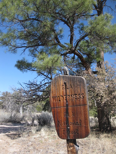
Aldo Leopold, the father of environmental ethics and wilderness conservation once said that, "Conservation is a state of harmony between men and land." As a 26yr. old husband and a father of 2 children, I'm not quite sure where I fall in the vast spectrum of contemporary environmental ethics and conservation, in fact I don't even know where I stand on most of the hotbutton issues that encompass the discourse surrounding human impact on nature. Call it youthful ignorance, deem me a fool. But there is absolutely one thing I know to be true, if conservation is harmony between man and the land, then wandering through the waters and tributaries of the Gila Wilderness, soaking in the hot spring gems and cresting the labyrinth of high mesas and snow capped mountains that make up the first nationally recognized wilderness area in the National Forest System is my preferred location for achieving that elusive state of harmony Leopold spoke of.
Spring in the Gila is an excellent time of year for the ultralight packer as temperatures are mild and precipitation low. The increasingly devious sun of spring is relentlessly feeding the ravenous thirst of the land east and west of the Mogollons through snow melt so water availability is abundant considering the typically dry environment. Spring backpacking in the Gila Wilderness offers numerous routes for complete self-supported backcountry immersion.
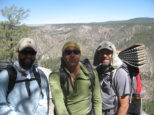
There was no real plan or agenda for this trip, simply and purely to move in rhythm and beat with the trail and to enjoy the beauty of the outdoors and each others company. The hikers on this trip would consist of: Ryan Bozzell, a BPL member and 2010 PCT attempting thruhiker; my father in-law Marty Miera who is a 54 yr. old pharmacist who has since reduced his pack weight in half since our first trip together; myself, a hardened trail runner fighting a nagging injury just looking to get out. Our feet would find their way up against the cold stream crossings and sharp canyons of the West and Middle Forks of the Gila River.
Giddyup!
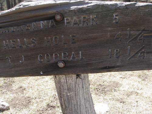
Day 1. TJ Corral–> Hells Hole (12 miles)
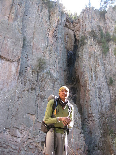
After departing Las Cruces, NM promptly and cheerfully at 5am we arrived at the TJ Corral parking lot eager to get moving in the brisk but sunny 32F morning. Ceremonial pretrip photo capturing and pack weight discussions ensued but we were quickly off to yellow blaze the 1 mile road walk to the Cliff Dwellings National Park trail head which is the jump off point for the West Fork. Besides the slight chill, the first thing our senses were made well aware of was the sound of the Gila River flowing loud and deep, with a veracity I hadn't seen before. Immediately my mind went to the trail #'s and I was beginning to ruminate an alternative route; apprehension was beginning to rear it's ugly head.

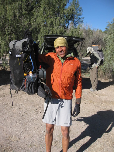
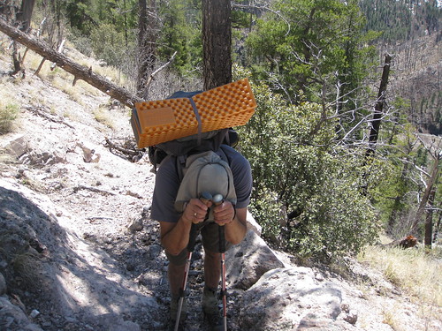
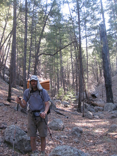
My full ULA Ohm pack weighed 13.44 lbs. with everything I would be carrying for the 4 day trip. The smile you see never faded but the "weight" on my back sure did with every day that passed and every calorie consumed. I was one happy ultralight camper.
Here is my gearlist for this trip:
Eugene Smith 4-Day/3-Season Gila Gear List
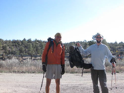
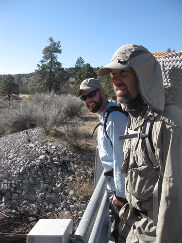
Ryans pack was also nice and feathery upon his shoulders. Ryan Bozzell is attempting Round #2 on the PCT at the end of the month, a rough bout of foot issues sent him home last June. He'll be attending the 2010 PCT Kickoff and heading 2651 miles north alongside the other hardened trail nuts.
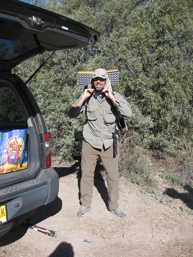
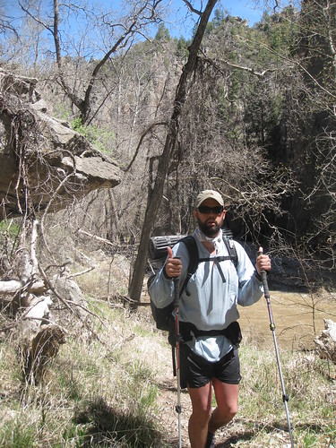
Marty making the last adjustments to his pack and clothing, clearly stoked on the blessing it is to backpack in the Gila.
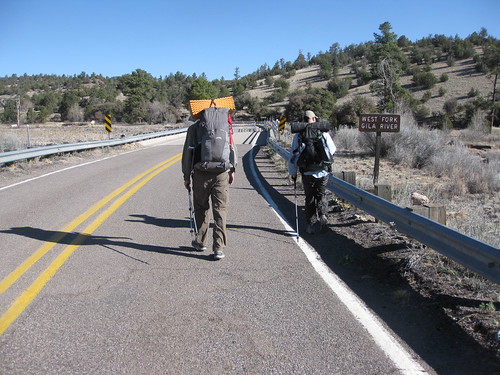
Some part of me really enjoys road walks to the trailhead, it somehow adds to the transition of regular life and backcountry life.
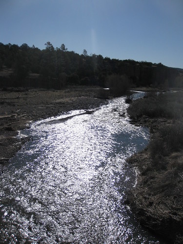
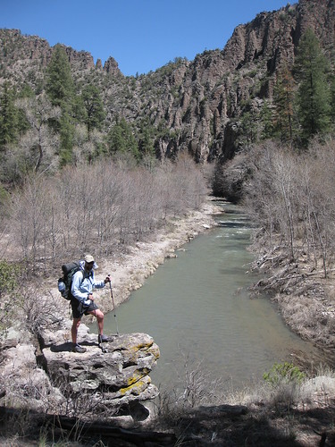
Our first glimpse of the Gila river.
All parties were happy to be moving but I think in the deep recesses of our gut we were slightly worried the stream crossings were going to be more than we expected.
Yellow Blazing
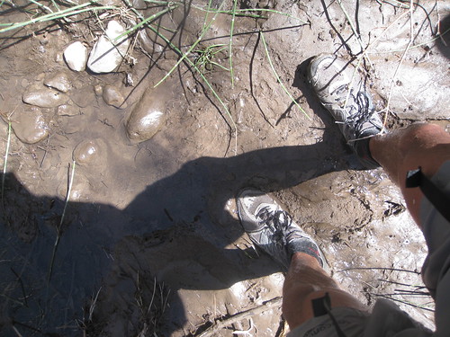
5 minutes into our trip we were presented with the first of countless stream crossings. The morning was still a chilly 35F but the sun was beginning to warm the air. No amount of sun was going to alter the cold temperature of the water, only our dulling nerve endings in the lower extremities of our body would dampen the chill. On we go.
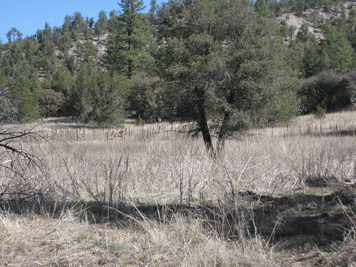
In the center of the photo you can see a large herd of deer scattering from the cottonwood lined waters of the Gila.
The views along the early stretches of the West Fork were enticing and elevated our spirits and our body temperature.
The awe factor didn't take very long to flow through our veins.
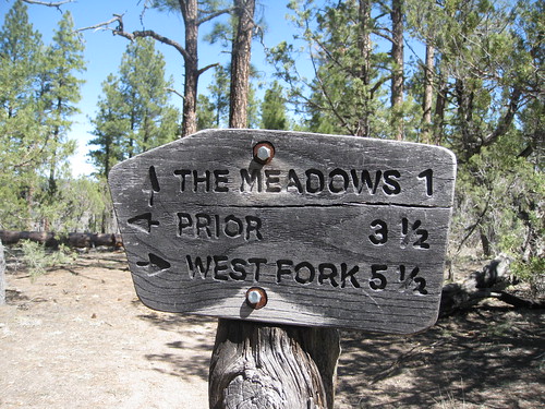
The first major trail junction was a deciding point for us. If we chose to head up stream along the West Fork we would have 10 1/2 additional miles of potentially dangerous stream crossings until we reached Hells Hole, our loose destination for the evening. Passing up the beautiful high walls of the West Fork wasn't one any of us wanted to make so we decided to push on through the river.
Temperatures rose quickly and made the cold crossings much more bareable. Here Marty easily makes it across.
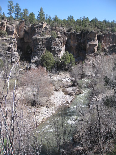
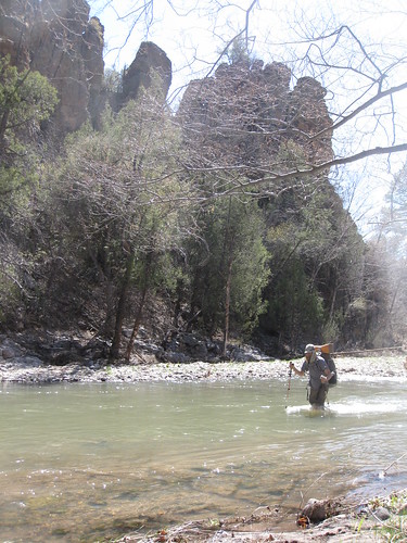
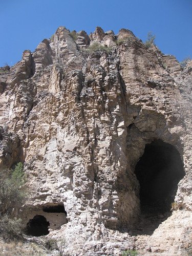
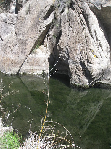
The dark features embedded in the walls of the canyon are remnants dwellings of the Mogollon people who lived in the Gila centuries ago.
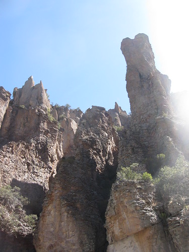
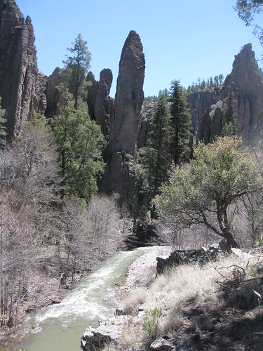
The tall features of the West Fork grow with every bend in the river.
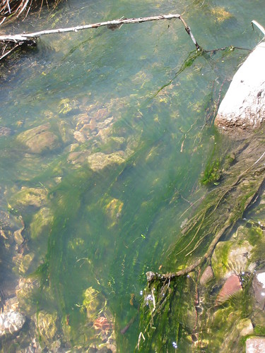
Water clarity was quite good considering the rate of flow, the silt was only a minor issue. The clarity was welcomed as it aided in footing and navigating crossings.
Beautiful outlooks over the river were abundant.
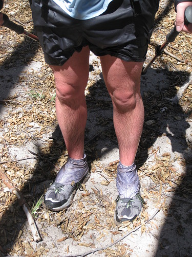
The lighter skin fella on our trip had a nice rosey hue to his legs due to the cold water.
We halted our pace for a brief late afternoon lunch. Marty is notorious for packing delicious trail food and snacks and he lived up to his reputation with a fresh fuji apple and peanut butter and salami. For him the luxury and nourishment is worth the weight; I envy his state of mind.
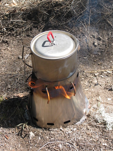
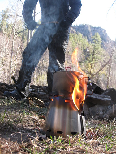
I took this lunch opportunity to efficiently stoke a small fire for my mashed potatoes in my Trail Designs TiTri Inferno setup I recently acquired for my MSR Titan Kettle. I cannot praise enough the speed and simplicity this little kit provided me in attaining boiling water for my meals. I failed to time the boil as I don't wear a watch but swiftly had 2 cups of cold river water at a rolling boil in about 5 minutes. The small tinder and twigs used to stoke the fire were completely incinerated in a matter of minutes; once cooled I broke down the optional titanium floor and properly deposited the spent ash in a small hole and covered the debris with dirt and pine needle. Only the most keen Leave No Trace observers and CSI watching gurus would've been able to detect the whereabouts of my little rendezvous with the TiTri Inferno. If I'm in the Gila this little stove will be in my pack from here on out.
Burn baby! Burn!
Serenity and chaos often battled it out like two giant titans, pulling at the yarn of our attention. Quiet sections of trail like this one were frequently interrupted with cold and swift river crossings. We took each dose with care and respect.
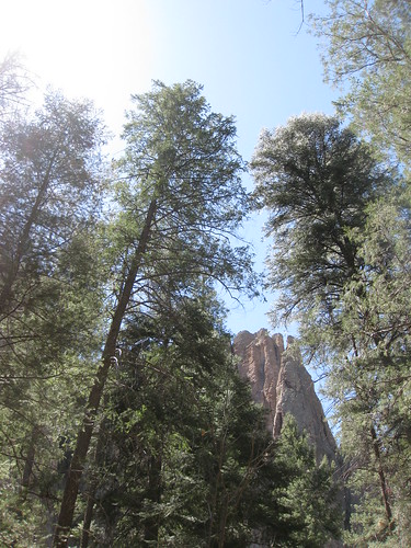
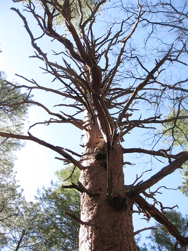
This looming giant Ponderosa stood watch like an ancient megalithic creature, walking under the shadow of this remnant tree felt as if we were flirting with the canyons ancestral past.
There was still ice formed in the dark recesses of the canyon walls. This large crevasse remained untouched from the suns wrath.
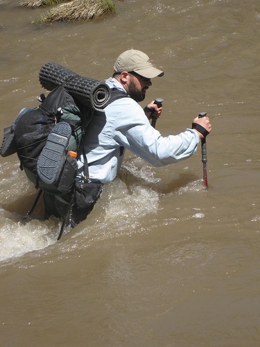
9 hours and only 12 miles later we arrived slightly weary and tired from the incessant and sometimes arduous stream crossings. We had several close calls towards the end of Day 1 crossing the Gila river. We reached one tenacious section of river that resulted in Marty losing his footing in navel high water and being swept back about 15 ft. or so. Luckily he was able to find his footing and regain an upright position and salvage the crossing, his smart use of a drysac kept all his down gear dry. I was growing tired and didn't have the confidence to safely cross a navel high section of water so I threw my pack across to Ryan, removed my Beartooth hoody and crossed shirtless in my track shorts with only my poles in the event I lost purchase in the water I wouldn't be foolishly trying to dry out any gear in the early hours of the evening. With the aid of my poles and a large branch extended out by Marty I was able to make it across and press on to Hells Hole for the night. What an adventure we were having already.
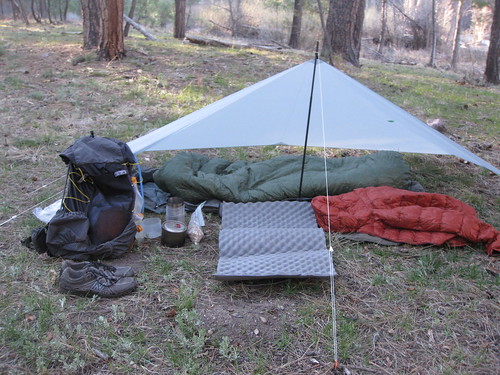
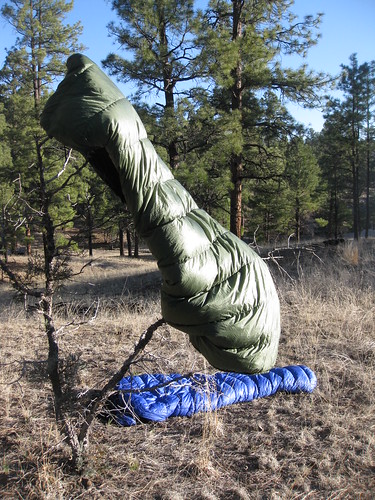
Here is a shot of my shelter setup and gear. I used the MLD Monk Spintex tarp as a wind break in conjunction with my MLD Superlite bivy as the gentle breezes coming off the Gila river in the night were potentially chilling. It would be a warm and comfortable evening.
Marty would bivy for the weekend and used a custom made Tyvek groundsheet/flat tarp as a windbreak. He had to supplement his 40F Marmot down bag with a down vest and Patagonia Cap 4 tights to maintain warmth in the evening so unfortunately his sleep was intermittent but he toughed it out and was able to hike briskly and with gusto in the morning. I was quite jealous of his pine needle cushioned, Big Agnes IC mattress and full length Z-Lite setup he devised.
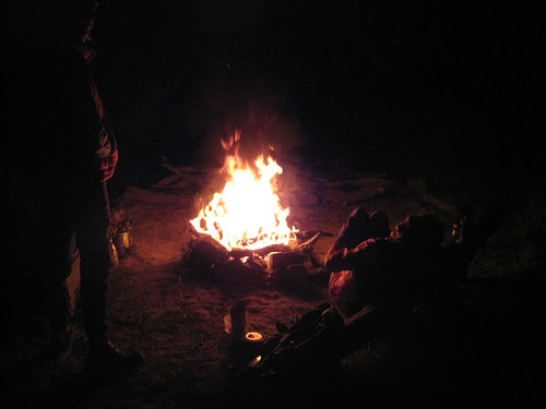
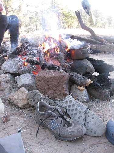
We donned our evening camp insulation and settled in for the evening. Fortune was on our side and there was a nice fire ring and some wood at our campsite. Campfires are atypical fare on backpacking trips for me, however we would enjoy a fire every night of the trip. The warmth and glowing embers of the fire complimented the jovial conversation of the days recollections and highlights. The hot coals and stoked flames would also be our backcountry kitchen for our evening meals.
Day 2. Hells Hole—> Prior Creek (15 miles)
I typically wake up at 445am to either hit the gym or get out for an early morning trail run, so I was up quite early and was greeted by the light of dawn and the gradual rustling of the birds in the trees.
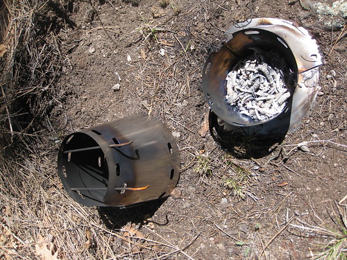
Once again the Trail Designs TiTri Inferno made quick work getting a boil rolling for my hearty oatmeal in the morning. To further attest to the multipurpose features found in the kit, I stored all my titanium stakes for my shelter in the food grade caddy that stores the Caldera Cone and Inferno insert and optional floor. The smaller half of the caddy would serve as my camp mug and the larger half made a great basin for rinsing out my Buff and socks at the end of the day. The hot embers left behind from the Inferno after my boil was also used to start the fire in the morning. Sweet!
All packed up and ready to hike. There was a little ULA representation on this trip. My stealth black ULA Ohm in the forefront and Ryans ULA Circuit in the rear. Both packs carry like a dream.
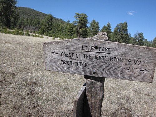
The topography of the Gila is a cartographers wet dream! Someone please update the Gila Wilderness map! I'm still dumbfounded why the first nationally established wilderness network isn't offered by Nat Geo.
No more than a mile into Day #2 were we greeted by more chilly river crossings. We were much more prepared and seasoned as the previous day expedited our graduation as Gila river navigators. Our selection, approach and technique was up to the task of the days ahead. Though a certain level of caution and respect was maintained.
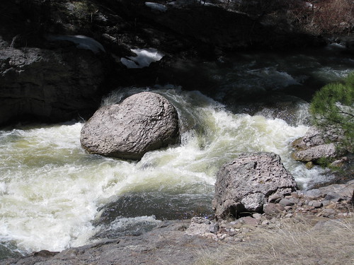
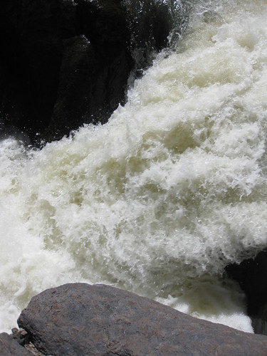
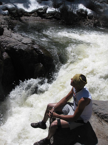
I wanted to take Marty to a cascading section of the Gila where the narrowing canyon and massive boulders create an idyllic aquatic playground so we took a short spur off the main trail. Unfortunately this year there would be no swimming and jumping off the rocks into the deep water holes of the river as the record snow fall in the Mogollon Range created a torrent of whitewater unfit for a dip. Nonetheless the display of power was inspiring and enjoyable.
During an average season you can pass the hours swimming and jumping off the rocks. The cold water and the swift currents led to a chute that wasn't worth being obliterated over.
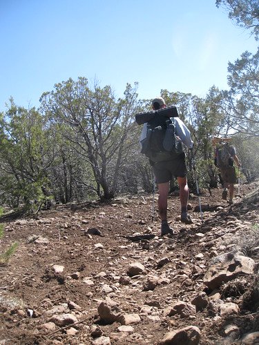
By early noon we were 18 1/4 mile into our trip, doesn't sound like much but with all the water crossings it felt like 40, we were a little mentally taxed and looking forward to dry trail runners and the high mesas. We would head up out of the West Fork and up onto the mesa to make our way to Lily Park for lunch.
The switchbacks out of the West Fork were quite intense and frequent. The lack of trail work and the west facing side of the canyon made for a hot ascent over the next mile. Marty rested it out occasionally and said he didn't feel prepared for the climbing, I disagree and think he did just fine!
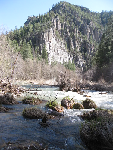
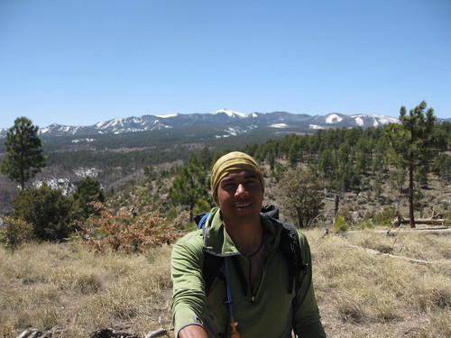
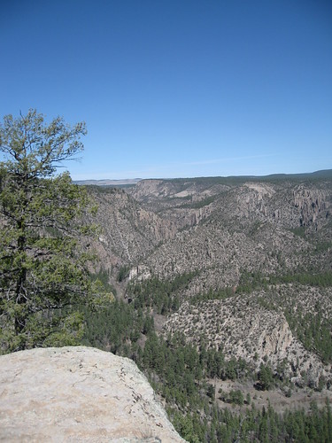
Once we crested the rim of the West Fork we were afforded great views of the not so distant Mogollons to our SW. You can clearly see the deep snow pack that has many 2010 CDT thruhikers slightly worried as the Mogollons are a common alternative and more scenic route through the Gila Wilderness.
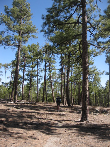
Ryan hamming it up for the camera doing his victory pose. It was nice to finally move into the faster rolling mesas under the shade of the Ponderosa and Juniper.
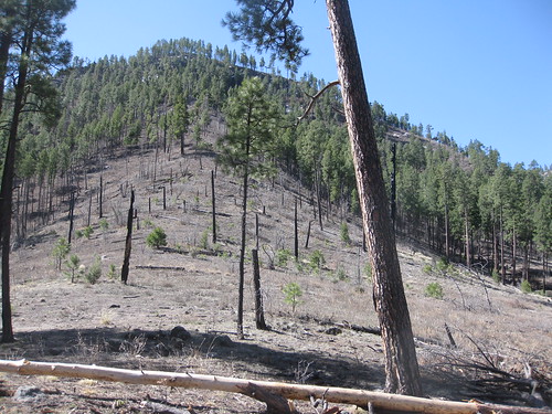
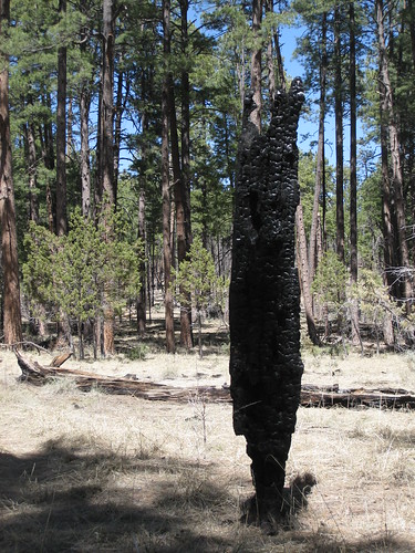
Elk are abundant along the mesas. I was unable to snap off a photo in time but a herd of about 16 elk broke through the forest a 100 yards ahead of me. There is no lack of photo opportunities for Ponderosa burn victims that are clinging onto dear life.

My New Balance MT100's were holding up fairly well considering the trail conditions and they complimented my fast paced style of hiking. However it was clearly evident from the few busted seams that the fluctuation of cold water, parched earth, melted snow and downed trees were taking their toll on the minimalist uppers of the MT100.
After a quick lunch under the shade of tree we began the 4 mile hike to the Prior Creek trail junction, it would be another 3 miles after that until we reached camp for the night. I had not received confirmation from the forest service office that there would be water available at Prior Creek so I tanked up on 2L of water in the event we needed to ration out water for the night. I was confident in the above average snowfall providing water for the evening but took the extra measure anyways.
The monotony of the high mesas in the Gila are both beautiful and eerie. There is something about the sparseness of vegetation and the stillness in the air that allows my heart and mind to wander. We walked spaced out in isolation so we could enjoy the silence in private. It is amazing how many things come to mind when you zone out on a long hike.
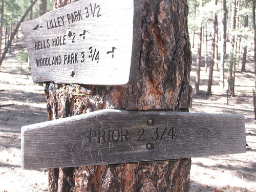
We covered the 4 mile trail from Lily Park to the junction for Prior in about 45 minutes, we were rolling. Only a short 2 3/4 mile jaunt alongside the clean waters of Prior, our decided destination for the evening.
The stream that constitutes Prior Creek would frequently dip below the surface of the ground which was a great sign, filtering would be thoroughly taken care of for us by the natural geological process and water wouldn't be an issue for the evening. This would be the highest water quality we would encounter along our trip and the most refreshing.
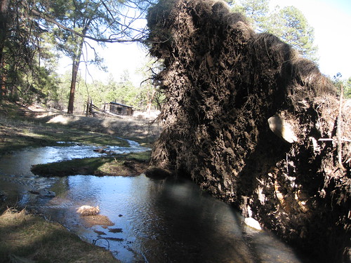
This hearty Ponderosa wasn't quite adept at handling the saturated soils created by the flow of Prior Creek. Hundreds of years of tree growth were easily uprooted by the gentle but consistent stream of water.
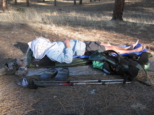
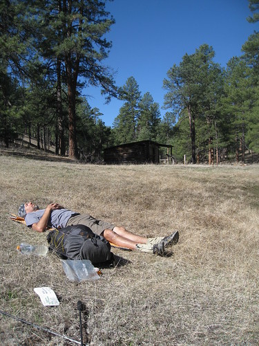
Day #2 was a long day and Ryan took the opportunity to catch some rest before settling in for camp. We would all bivy under the stars to minimize our footprint and make use of the small knoll we called home for the evening.
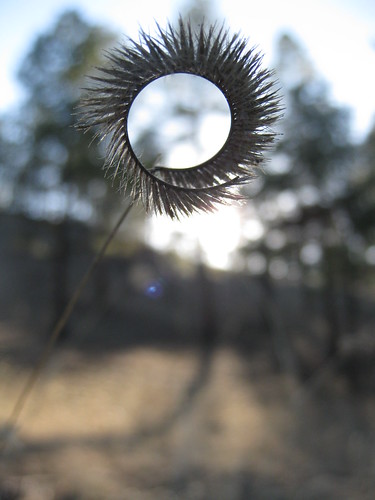
I took the opportunity to observe the small details.
Great conversation with exceptional company capped off the night. Day #2 was in the bag and it was a good one.
Day #3. Prior Cabin—->Jordan Hot Springs (12 miles)
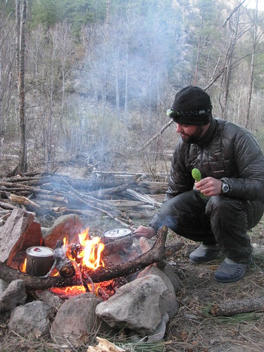
Ryan awoke early as did I on the morning of Day #3 and began to stoke a small fire for cooking and warmth. The night was quite brisk and temperatures dipped into the low 20's by my guess. I had a solid 1/2" of frozen water in both my Evernew containers. Ryan breathed a little to heavily in the night and created a microclimate inside his Oware bivy, that increase in condensation and ice crystals compromised his loft a tad so the morning hours were chilly.
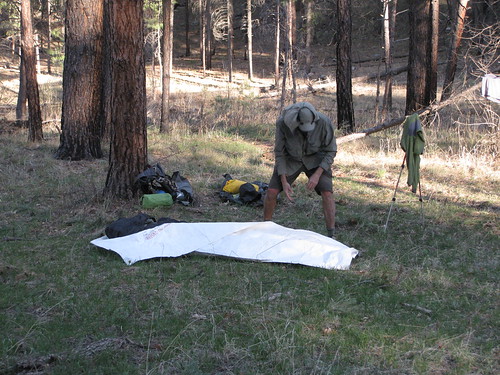
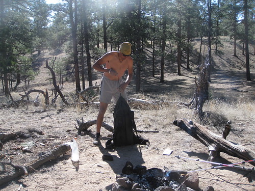
Taking care of the gear before stuffing it back into the bottoms of our packs.
Drying out the ice crystals in my shoes and boiling water for some coffee. We were in no rush to get on the trail as we had a long day ahead and only about 12 miles to hike.
Cinching up the collar and heading out in the warm morning sun.
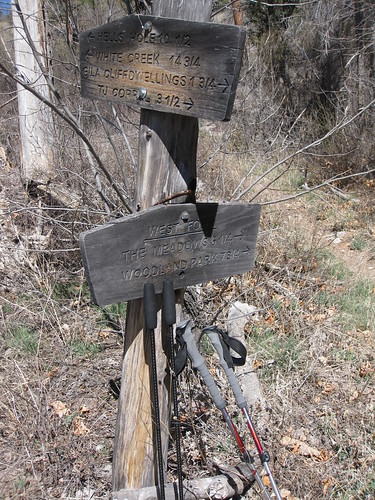
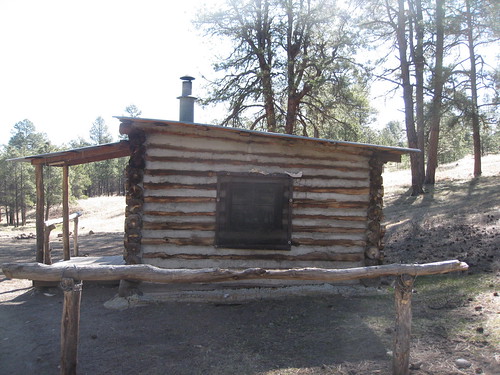
There are several old establishments within the Gila Wilderness system, Prior Cabin is a popular destination for backpackers venturing into the Gila. Unfortunately it is a padlocked facility so hut style trekking isn't an option.
Marty accurately captioned this image. "Life is Good!"
When you head NE out of Prior along Woodland Park you are brought out of the Ponderosa and quickly transition into the low shrubs and Juniper scattered flats of the high mesa. The trail here was mottled and adorned with a nice shoe abusing rock carpet.
We made excellent time and covered the 3 1/2 mile trail segment to the rim of the Middle Fork in less than an hour. From here we would begin the steep descent down into The Meadows then head East along the Middle Fork of the Gila River.
Along the rim. In the distance is the headwaters of the Middle Fork.
Gotta love Ryans SticPic!
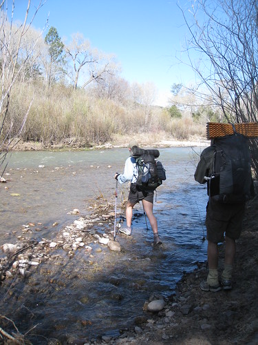
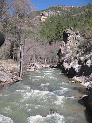
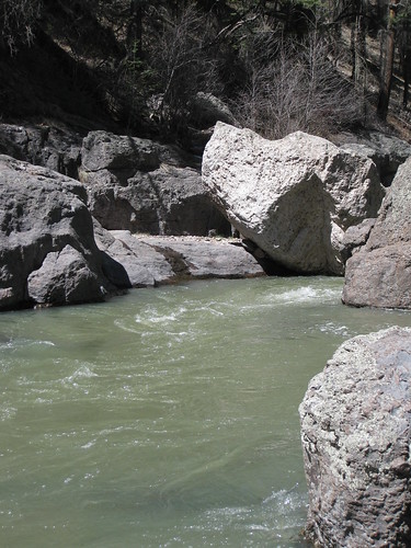
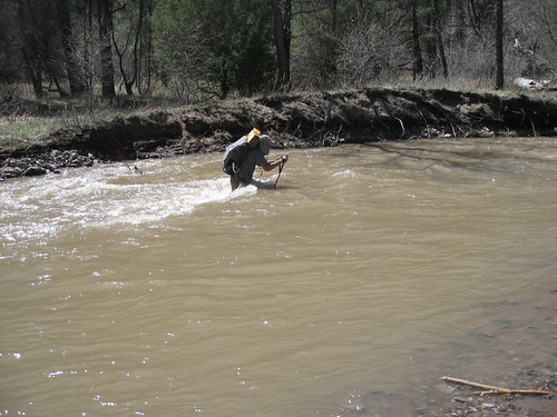
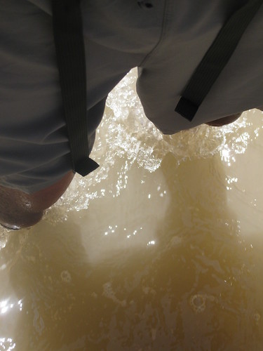
Once we reached the floor of the Middle Fork the continuation of river crossings ensued. We were learning the language of the river quite well and the subtle patterns were becoming easier to decipher, however the Middle Fork of the Gila differed greatly in its clarity. We weren't able to see the river floor so relied heavily on the trekking poles to feel our way across the water. Trekking poles were not so much an option as they were a necessity on this trip.
Marty is somewhat of a masochist and he is clearly loving this stream crossing way too much! Excellent!
The Gila is dotted with secret hot springs that pop up along sections of the river, sometimes literally in the river. Tiny and fragile microhabitats exist in these tepid water conditions and organisms abound and wild flowers flourish.
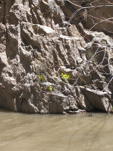
Nature is resourceful. Wildflowers triumphantly cling to the pebble filled cracks of stone.
Here I desperately cling to the tumbling and shifting stones of the river bottom floor.
Ryan was served a healthy diet of river crossings; I believe he's much more prepared for the Sierras in his upcoming PCT thru.
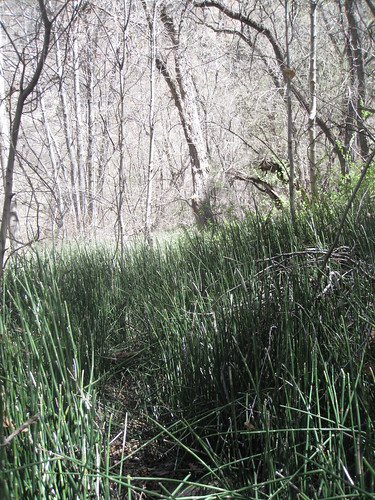
Trailblazing through cattail strands was common. I found these segments to be the most taxing on the body as the outside sheath on the plants would slap the insides of our legs and thighs relentlessly. Holding out our trekking poles like a plow helped slightly.
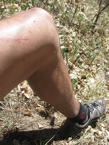
Beat up legs and tired feet.
Serenity.
"Trail"
The photo above concludes the photographic segments of our trip. I think Ryans double thumbs up accurately summarizes the trips entirety. Unfortunately not too long after this photo was taken I dropped down into a hole in the bottom of the river and was immersed mid chest in the rapidly flowing water. Foolishly I failed to place Ryans camera in an Aloksack and the loosely resting camera inside my Ohms hipbelt pocket experienced a chilly Gila River baptism. The battery shorted out and we were left with nothing to document the remaining 2 days of our trip.
I'm like a canoe without a paddle with no images to work off of so I'll briefly conclude the remainder of the trip.
We finally arrived to Jordan Hot springs and took a 45 minute hot soak in the deep clear pool to ease the tired muscles. The third night was easily our most relaxing evening; mild temperatures; deep black sky and vivid stars; warm food; hot fire; and warm beds dictated the details of the evening. My eyes peered out of the top of my quilt and lingered long into the night.
Day #4. Jordan Canyon—> TJ Corral (7 miles)
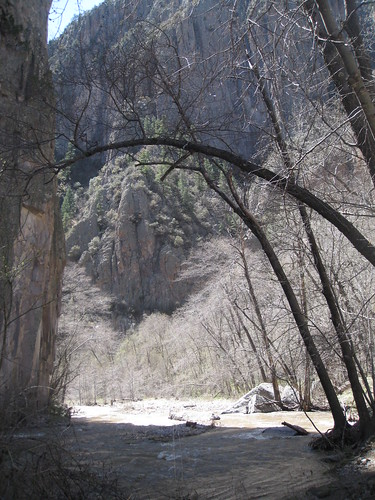
The section of canyon between Jordan hot springs and Little Bear Canyon, our way out, is arguably the most scenic and deep of the Middle Fork. It saddens me that I wasn't able to document the rest of the giant loop I conjured up for our trip.
We made quick work on the trail and were back at the vehicle in about 2 1/2 hours. A large group of Boy Scouts of America was also on their way out of the mesa overlooking the Middle Fork a mile shy of the trailhead. The strained faces of the young men carrying packs exceeding 50lbs. was unfortunate. Many of the Scout leaders and volunteers looked curiously at us as we danced along the trail past the blisters and towering packs. I found it to be such a dichotomy to the method of travel and enjoyment we encountered in the Gila over the last 4 days. I asked one brisk footed young fellow (possibly the next Andrew Skurka cause he was well ahead of the pack) if he was enjoying himself, he gave me a cracked smile and nodded his head. Sweet reassurance. There is no doubt, that whatever method of travel you choose, if you're in the Gila Wilderness then you my friend are truly blessed.
Apr 14, 2010 at 7:05 pm #1598150Being very busy with work my hiking has been limited to training day hikes. Thanks for the great trip report, man I needed that.
Apr 14, 2010 at 7:09 pm #1598152Nice trip report! That place looks great.
Apr 14, 2010 at 7:31 pm #1598160Wow
Gotta go!
Apr 14, 2010 at 7:34 pm #1598162Eugene,
You're quite the writer! I thouroughly enjoyed following your journey.
Thank you for the time it took to share with us.
Todd
Apr 14, 2010 at 8:45 pm #1598189Thanks for the kudos, I thoroughly enjoy this aspect of the BPL community. Sometimes a picture is worth a thousand words, or in the case of my long winded trip reports and feeble attempts at journaling, a couple thousand words! Cheers. :)
Apr 15, 2010 at 4:00 am #1598242Really enjoyed your trip report! I have not made it out to New Mexico ("yet") and your trip report has inspired me to get out there sooner than later. The Gila area looks like a great backpacking opportunity. It seems like you are a short jaunt away, that's nice. You just don't get that type of scenery here in Florida.
Ric
Apr 15, 2010 at 4:37 am #1598249awesome report!!
Apr 15, 2010 at 6:08 am #1598268Thanks for your great trip report, Eugene. It looks like you guys had a lot of fun. The Gila seems awesome. I'll have to make it down there some day.
Apr 15, 2010 at 8:00 am #1598292Exemplary trip report! Never been to the Gila. Obviously that needs the change.
Apr 15, 2010 at 3:50 pm #1598448Hi Dondo
Great report.
I see that each of you crossed the rivers solo? This is not always the best method. We cross in groups, arms linked, with the strongest upstream. If it is really rough stuff we can move one person at a time while everyone else supports. This is MUCH safer than solo, even with trekking poles. Just a thought.
Cheers
Apr 15, 2010 at 4:50 pm #1598459Trip reports such as these and the wonderful accompanying photos do wonders for my soul. You are a talented writer, which helps set the mood. I must make the trek to NM and the Gila wilderness one day, but a part of me feels as though I have already been. Thank you for sharing! Glad that you all made it safe, save for the camera. Truly a pity, but at least we have what you had taken.
Awaiting the next trip report!
Apr 15, 2010 at 4:58 pm #1598462This looks like an amazing trip. It makes me kick myself for not visiting that area when I lived in New Mexico.
Apr 15, 2010 at 8:34 pm #1598520Excellent trip report!
HJ
Apr 21, 2010 at 3:14 pm #1600591Great report! My friend just got back from the Turkey Creek hot springs and encountered that record snow melting too. I really enjoyed my first trip in the Gilas last May and have been looking at that area around the cliff dwellings for my second trip.
We need to send you and Tony on the same trip and have a trip report off afterwards! You guys are outta control!!!!
Apr 21, 2010 at 5:05 pm #1600643@ Justin,
Thanks man! I'd love to take a trip with Tony and his crew of BPL members over there in California, they go on excellent trips. I don't think I could keep up with Tony's trip reports though, the JMT trip report is quite epic! Honestly, Tony's trip reports kinda raised the bar quite high and I look forward to them in the year.
Justin, if you're ever in New Mexico or planning a trip and need some ideas shoot me a PM and maybe we could figure something out. The Gila is a great destination, no permits, no bear canisters, no crowds, no rangers, just open trail and over 1/2 a million acres of relatively untouched land to explore.
Apr 21, 2010 at 8:41 pm #1600751Would love to share a trip with you Eugene!
I enjoy your style of writting…makes me think that on future trip reports that I should take more time to write my story of what happens.
For whatever reason, I have tended to just put the facts of what is in the photo as a narrator when I could be telling a story of what happen too.
For now, I am very content to read what you are putting up for trip reports.
Honestly, after doing the Tahoe Rim Trail Photo Essay I am kinda burnt out.
As proof, I have yet to finish the last trip for the BPL trip to Henry Coe.
Still, think it would make for a heck of a trip report if we had a joint one of a trip we took together.
P.S. If I raised the bar, then I an tell you that burning myself out on trip reports/photo essays just means that I hung myself from that bar. LOL!
-Tony
Apr 22, 2010 at 10:20 am #1600912Thanks. I hope to hike that area in the near future.
Apr 27, 2010 at 2:37 pm #1602868Eugene,
It's too bad you lost the use of the camera for the last two days. Definitely enjoyed the read and the pictures. Looks great.
Apr 29, 2010 at 6:06 am #1603486Eugene,
Great TR. It was interesting to see the similarities and differences with my trip to the Supes, just east of Phoenix. Looks like you had much more water from the surrounding peaks, although the river is about the same elevation as what we were doing.Thanks for sharing!
Jul 9, 2010 at 4:09 am #1627498Eugene,
Great trip report, and I am beginning to really look forward to your entries as a reminder of what we all love about the outdoors. And probably why we all gather here around the online BPL campfire.
Quick question: I noticed this trip had its fair share of river crossings and wet walks. Can you weigh in with a few words on the choice of trail runners you and your friends wore, and how that all worked out with regard to drying time, comfort, and the state of your feet? Especially in the cold that you wrote about, and what you did then with regard to socks, too.
Thanks in advance.
Incidentally, I work as a photographer — nice to see someone paying such attention to the visual record of their lives and adventures.
-
AuthorPosts


- You must be logged in to reply to this topic.
Forum Posting
A Membership is required to post in the forums. Login or become a member to post in the member forums!
Our Community Posts are Moderated
Backpacking Light community posts are moderated and here to foster helpful and positive discussions about lightweight backpacking. Please be mindful of our values and boundaries and review our Community Guidelines prior to posting.
Get the Newsletter
Gear Research & Discovery Tools
- Browse our curated Gear Shop
- See the latest Gear Deals and Sales
- Our Recommendations
- Search for Gear on Sale with the Gear Finder
- Used Gear Swap
- Member Gear Reviews and BPL Gear Review Articles
- Browse by Gear Type or Brand.
