Topic
Trip Suggestions for Father and 8 y/o Son
Forum Posting
A Membership is required to post in the forums. Login or become a member to post in the member forums!
Home › Forums › General Forums › General Lightweight Backpacking Discussion › Trip Suggestions for Father and 8 y/o Son
- This topic is empty.
-
AuthorPosts
-
Feb 27, 2010 at 8:06 am #1579345
And another FYI… the shuttle system in Yosemite is so extensive that given sufficient planning you can get anywhere you want. Between the YARTS that runs from Mammoth or Merced into the park, the hiker/tour bus that runs between the pass and the valley, and the free shuttles that run on Tioga and the others that stay in the valley – you can go anywhere, given you have cash for bus fare.
schedules at:
Yarts.com
yosemitepark.comYARTS will pick you up at the aiport or at the AMTRAK station in Merced, and has 5-6 stops in Mammoth.
The shuttle to SEKI is less extensive, but connects to the free shuttles, such as they are:
http://www.nps.gov/seki/planyourvisit/publictransportation.htm
Feb 27, 2010 at 10:02 am #1579388The Olympics and Sierras are sounding pretty cool. I went camping on the Olympic Pennisula when I was nine and though it was really cool. Kids seem to like beaches, and cool creeks so it might be a winner. What did get old was the constant rain so that might be something to check.
Heres a couple other ideas.
1. I always thought it would be really cool for a kid to ride the Silverton-Drurango railroad and then go hiking. Only problem is that its pretty high elevation out there.
2. I really like the Lost Creek area near Denver especially the loop over McCardy Mountain. We started at the east end of the wilderness where its lower so we gradually aclimitized.
3. Its not out west but since you're in the sounthern appalachians you might want to check out Grayson Highlands for a shorter trip. I love the scenery but the highlight for my little brother and his friend was the wild ponies.Feb 27, 2010 at 11:47 am #1579411The Emigrant Wilderness is a great place with tons of fishing lakes and the hiking does not seem that challenging. There are tons of trails and lakes so you could easily make a week trip out of it.
Also – You don't need to reserve a spot. Just show up for the permit.
Feb 28, 2010 at 5:17 pm #1579852Luke–I love the idea of the railroad / hiking trip too, but, as you mention elevation is an issue and someone else mentioned the trail being pretty tough in that area. Maybe when he's older. Still a possibility since that's pretty unique.
I'll have to check out the Lost Creek thing–I don't know anything about it, but I'm sure there's some info on the internet.
Grayson Highlands is great. I've been there, but my son hasn't. Def need to take him there, but for this trip, I want to blow his mind with some big Western mountains!
Thanks for the suggestions.
Feb 28, 2010 at 5:31 pm #1579861Laurence–I think I'm homing in on the Sierra for this trip. The no reservations areas are my preference. I've always hated reserving campsites. Kind of goes against everything I try to get away from when I'm hiking. I'd like to do some reading on this area–if you know of a good website or book, please let me know. Thanks!
Feb 28, 2010 at 5:55 pm #1579868There are buses (Clallam Transit) that ply US 101 around the Olympic Peninsula. Unfortunately, the trailheads are all many miles off US 101. Just getting to Port Angeles won't get you anywhere near a trailhead. There used to be a trailhead shuttle service, but the owner passed away last year and I haven't heard that anyone has taken it over. If you find any by googling, telephone first to see if they still exist. Unless someone else has taken over this service, I can't see your getting anywhere in the Olympics or Cascades without a car. There are plenty of good loops in both Cascades and Olympics, though, so a one-way trip is not essential! With the steep, muddy bypasses (some with rope ladders) to get over headlands that can't be bypassed at low tide, I'd question whether the Olympic coastal hike would be suitable for your son. Maybe in a few years!
Note bear canister requirements in much of the Sierra (especially in the national parks) and in most of Olympic NP. While ONP (as of a year ago) didn't require canisters below timberline, they did require them above timberline and on the coast (the latter due to aggressive raccoons), and they told me they want them to require them everywhere. You can rent them for $3 at the Port Angeles visitor center or the Forks ranger station. Check out the websites for the areas you're going (www.nps.gov for National Parks, http://www.fs.fed.us for National Forests) for specific requirements.
Feb 28, 2010 at 5:58 pm #1579870Brian,
I have become a big fan of Emigrant over the past few years. I would highly recommend this book for information on the area: Emigrant Its a tough book to find for sale, but it has great trail descriptions and a corresponding map.
Here is a well done trip report by Tony that will give you a flavor for the area:
There are quite a few people on the forum who are familiar with this area. I may be able to answer questions about a particular trail or point you to someone who can.
Feb 28, 2010 at 6:02 pm #1579873Thanks Mary. I'm leaning towards the Sierra. Bear can is no problem and I'll make sure I follow the rules. I just need to get some maps and some info about different trails and plan a route. If you know any good resources for that stuff (books or websites or whatever), please let me know.
Feb 28, 2010 at 6:25 pm #1579878David–again, I keep getting great info here, so thank you and everyone else. The photos I find of Emigrant (including Tony's excellent trip report) are gorgeous. At the risk of wanting something too demanding for my son, I'm hoping to find views of larger and more dramatic mountains though (i.e. John Muir Trail). It's probably impossible to find a route that an 8 yr old can handle, not have crazy elevations to deal with, etc, while still having those vistas. Emigrant makes sense (and I'm certainly not saying that it isn't stunning), but if I can give him a bunch of those "wow" views at every turn, that's what I'm looking for. But I don't want to turn it into a death march either!
edit: the more I read…I think you are right. Emigrant looks amazing and fits my needs perfectly for this trip. I'm going to get that book.
Feb 28, 2010 at 7:38 pm #1579901What's the bear situation? ie…need a bear can? Just hang it?
SD
Feb 28, 2010 at 8:07 pm #1579905It sounds like you've homed in on Emigrant Wildernessn which sounds great. If for whatever reason you want to look at CO let me know, the Lost Creek Wilderness area was my stomping grounds for a while and I know most of the trails very well, there are also several other people here that know the area.
I'm also really like Indian Peaks Wilderness, its a bit crowded but the scenery is amazing and I didn't think it was too hard (my little sister took it like a pro).The Grayson Highlands idea reminds me of another idea, my little brother LOVES his cheap digital camera. He doesn't take the best pictures but they are HIS pictures so he likes taking them and it keeps him entertained.
Feb 28, 2010 at 8:28 pm #1579913"What's the bear situation? ie…need a bear can? Just hang it?"
A bear can is not required. The black bears there are not quite as smart as the ones in Yosemite, just a few miles to the south. A proper counterbalanced hang should be sufficient.
–B.G.–Feb 28, 2010 at 8:28 pm #1579914Brian,
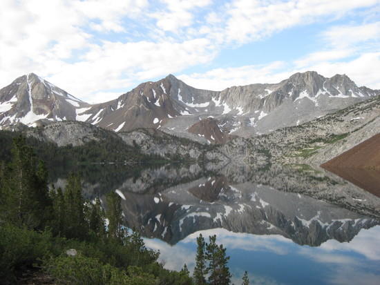
I can understand wanting he big vistas and wow factor of the high sierras. I think you can discover some of the same thrills in parts of Emigrant. I personally loved visiting Emigrant Lake. Leavitt Lake and High Emigrant Lake are on my list for this summer.
I have not hiked it personally but I have been told that one of the more scenic portions of the PCT travels through the area.
There a lot of great suggestions in this thread. You can't go wrong.
Feb 28, 2010 at 8:59 pm #1579927Right, canisters are not required in Emigrant and based on this sample of one hiker, are unwarranted there. There's huntin' in them thar hills, if you get my drift.
I like Emigrant and go there pretty often. There is an extensive trail network and all sorts of interesting trips can be stitched together comprising alpine meadows, lakes, creeks–whatever terrain you prefer short of vast stretches of high alpine (for that, head south).
My Emigrant bête noire are the commercial packer thoroughfares (most of the main access trails). They've flogged them all into yards-wide rubble fields that are hell to hike. With careful trip planning you can generally leave the critters behind a day in.
Cheers,
Rick
Mar 1, 2010 at 1:25 am #1579963You should check out the trail that starts out at convict lake near Mammoth CA. Its right next to the mammoth yosemite airport so I assume there would be a way to get there from LAX, Ontario, Etc.
I've hiked the trail and it's a great trip. You can take it all the way up to Lake Dorothy and even to Lake Genevieve.
Beautiful scenery the whole time, lots of fishing (creek and lake) and the weather is usually pretty nice.
Trailhead is at 7700 feet and Dorothy is at about 10,200 feet with lake Genevieve falling back down about 10k.
There is an alternate (shorter) trail that can only be accessed via a very rough road you'll need a 4×4 car for, but the convict trail is very accessible right off the 395 freeway.
I think this is one of my favourite places in the sierra's because not many people hike it and it allows me to get fishing in pretty much every day on the trail. I've gone up for a whole week with some friends and had an absolute blast around some of the most beautiful scenery around.
 Mar 1, 2010 at 8:05 am #1580015
Easy logistics combined with scenery.
Here's a TR from someone here that did the trip in a way I was suggesting. http://www.backpackinglight.com/cgi-bin/backpackinglight/forums/thread_display.html?forum_thread_id=9499
I am not sure it is suitable for your son or not but that's up to you to decide. It's a consistently high altitude area.
Mar 1, 2010 at 3:40 pm #1580173Well, we certainly don't lack for lots of beautiful places in this country, do we? All of your suggestions are appreciated very much. Emigrant sounds perfect, but after some research today on flights, it's an expensive flight (about $600/ticket) to MMH and a reeeeally long trip out there (9+ hours just on planes and airports). Red eye on the way home too unless I fork out substantially more $. South America would be cheaper and almost as fast! Yes there are other routes, but not much cheaper and more complicated.
Here in Atlanta we have all kinds of deals to CO now (i.e. Durango and Grand Junction for $250 r/t). A quick search says Aspen is $450 r/t and fast. It's not all about money, but still, it's a huge difference. The Aspen scenario is so simple and beautiful, and Durango is priced super low, so I'm leaning towards CO now. I mean it's not like it's some shabby destination!
Any stellar trail suggestions with easy access (prefer no car rental) from Durango or Grand Junction would be appreciated.
As for elevation, well, that's an issue, but then again, when I was a kid I flew to CO many times and never had any issues. On the lifts as soon as I landed. But back then nobody told me it was an issue.
Mar 1, 2010 at 3:50 pm #1580179BTW…this guy has some nice trip reports. If they don't make you want to get out, nothing will.
Mar 1, 2010 at 4:22 pm #1580195http://www.rockymountainscenery.com
The Aspen hike mentioned ealier where you can bus to the trailhead is the one in Maroon Bells Wilderness, the Four Pass Loop. Falcon has a book for Maroon Bells. I've heard it described as "so beautiful it looks fake."
It's on my short list.
Mar 1, 2010 at 4:32 pm #1580202Dean–searching Four Pass Loop is actually how I found that site–beautiful huh?
The one labelled "Wildflower Trip" is really stunning too and I'm trying to figure out logistics for getting from the Durango airport to that trail. Seems easy with a car, but prefer a shuttle if possible.
I'll check out that website you suggested. Thanks!
Mar 1, 2010 at 5:01 pm #1580221I can't comment on transportation much. But since you seem to be heading for CO heres my 2 cents.
Elevation
I personally wouldn't sweet the altitude. My five siblings and I went to Colorado most summers since I was a little kid and we never had problems, we just took the first couple of days real easy.Places to Go
If you want jaw dropping scenery without much driving, I would go for Indian Peaks Wilderness. Popular day hikes like Isabelle Lake can be crowded but once we got past the day hikers it didn't seem too crowded. I would guess its better than most CA wilderness areas. I just checked a map and the trip we did across Indian Peaks could be turned into a loop by connecting it to another trail (that would be Cascade Cr. Trail, Beaver Cr. Trail, and Buchanan Pass Trail. The pictures on Google Earth look very nice. Check DondoOudoors for a trip report he did on this hike.The reason I liked Lost Creek Wilderness is that it has some cool stuff at relatively low elevation. There are two loop hikes on the eatern half of the Wilderness. Heres a link to my trip report on this area and another
http://www.backpackinglight.com/cgi-bin/backpackinglight/forums/thread_display.html?forum_thread_id=25400
http://www.backpackinglight.com/cgi-bin/backpackinglight/forums/thread_display.html?forum_thread_id=21117
1. The Goose Creek loop (about 20 miles). Its got a lot of cool rock formations but not the really dramatic scenery.
2. McCurdy Creek trail combined with other trials makes a 27 to 31 mile loop depending on where you start. It has the rock formations and the trail is at or above treeline for about five miles with some nice views (although not as good as Indian Peaks). If you hike counter clockwise starting at Lost Park Campground its not too hard. Avoid the Ute Creek trailhead because its a brutal climb.If it was me personally I would lean toward Indian Peaks if I wanted really impressive scenery without a lot of driving. If elevation turns out to be a problem Lost Creek could be a backup option.
Have fun!!Edit – If you're flying into Durango why not take the train and hike in the San Juans?
My family likes the scenery of the Aspen area but not the flys they say they are the worst they've seen in CO so be ready.Mar 1, 2010 at 5:22 pm #1580234Luke–I'm on the Durango-Silverton train website right now. Can you tell me what trails are in that area or where I can go to get more info, maps, etc? I think the CDT passes thru there if I remember correctly. Need to find out if he can handle those trails and logistics for putting this all together, though.
Flys huh? Are you sure, that's not mentioned on any of the Aspen tourism websites.
Mar 1, 2010 at 5:33 pm #1580240Yes flies were bad when we went up for a day hike near Crested Butte and my family said they were bad on the Aspen side the next year. This was at lower elevations so maybe its not as bad higher up. Aspen and Crested Butte are known for sking and wildflowers which I would assume means they get more moisture which contributes to the problem.
I can't tell you as much about the Silverton-Durango area because I haven't been able to do much of anything down there except drive through. The Colorado Trail does go through there and my parents too me hiking along it when I was about 2 years old. The pictures look nice. Looking at a map I don't think its perfect (looks like kinda steep climbing)but I'm sure you could figure something good out. I heard the train ride was relatively pricy so I don't know how it compares to a rental car.
Edit
I forgot the CDT trail goes through there too I hear its almost all above treeline and very scenic. I would recommend downloading the free Google Earth. Once you get used to it its a cool way to check an area out and there are lots of embedded pictures. Andyskurka.com has pictures of this area from his Colorado Trail hikes.Mar 1, 2010 at 5:46 pm #1580248C'mon, you don't remember the trip when you were 2?
I have Google Earth, always forget to use it–lol. I'll check Skurka's site too.
FYI–the train is about the same price as renting a car. Max speed is 18mph, though.
Mar 1, 2010 at 5:57 pm #1580252I just mapped out about a 33 mile route on DeLorme Topo assuming the train stops at both trailheads you could go up Elk Creek and across the mountains to Vallecito Creek than cross the mountains again and go down Neeldle Creek to the railroad (or the other way around). I haven't done a fancy calculation/comparision of elevation gains etc. but this looks doable doing about 5 to 6 miles a day. It does look like there are going to be some steep climbs with a lot of switchbacking. I'm sure there are some good guidebooks for the area if you hunt around.
I see lots of other cool destinations in the area but you'll have to decide how comfortable you are spending a lot of your time above treeline to do some of them. -
AuthorPosts
- You must be logged in to reply to this topic.
Forum Posting
A Membership is required to post in the forums. Login or become a member to post in the member forums!
Our Community Posts are Moderated
Backpacking Light community posts are moderated and here to foster helpful and positive discussions about lightweight backpacking. Please be mindful of our values and boundaries and review our Community Guidelines prior to posting.
Get the Newsletter
Gear Research & Discovery Tools
- Browse our curated Gear Shop
- See the latest Gear Deals and Sales
- Our Recommendations
- Search for Gear on Sale with the Gear Finder
- Used Gear Swap
- Member Gear Reviews and BPL Gear Review Articles
- Browse by Gear Type or Brand.
