Topic
new garmins foretrex 301 and 401
Forum Posting
A Membership is required to post in the forums. Login or become a member to post in the member forums!
Home › Forums › Gear Forums › Gear (General) › new garmins foretrex 301 and 401
- This topic is empty.
-
AuthorPosts
-
Jun 27, 2009 at 6:20 am #1510738
I think the Suunto's have some sort of intermittent setting where it comes on gets a reading and then turns the receiver off, so you can extend the battery quite a bit without having to always be fiddling with the watch. Perhaps, an owner can confirm their experience with this. I'd also be interested in hearing about its sensitivity and ability to hold signal under cover, both issues for the X9i.
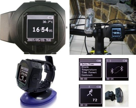
I may have found a GPS watch that tops them all. Its design simply screams, "I am a serious professional!" as only someone purely interested in function would be caught wearing this thing:

Okay, all jokes aside, this is a bit intriguing. Priced at under $100 and with a SiRF chipset and Lithium-Ion battery supposedly giving over 300 hrs of use. Can't find out much about it. Probably vaporware.
Might not be too terrible on a pack strap. :-)
Jun 27, 2009 at 6:35 am #1510740I think the Suunto's have some sort of intermittent setting where it comes on gets a reading and then turns the receiver off, so you can extend the battery quite a bit without having to always be fiddling with the watch. Perhaps, an owner can confirm their experience with this. I'd also be interested in hearing about its sensitivity and ability to hold signal under cover, both issues for the X9i.
Both version record waypoints at 1 s or 1 min intervals. With the 1 min interval, the battery time is at least 10 hours, see this and this track:

The accuracy has definitely gotten better with the X10.
Jun 27, 2009 at 6:49 am #1510742Roleighj, I am confused by your comment about batteries. Do you mean rechargeable instead of disposable? Aren't alkine batteries disposable batteries? Do solar recharges work?
BTW I like my Foretrex 101 better than my Gecko 201 because of the convenient, hands-free way it is carried.
Aug 25, 2009 at 9:10 am #1522885I'm starting to lean this way (401)- relatively light- I'm sure the band would save a few grams as well, sensitive receiver, altimeter- sounds like the compass feature might not be all that great from Roger's post, but maybe OK if kept very level
I was looking at a Suunto, but simply too many poor reviews- yeah there are a few good ones, but they seem to be overshadowed by the bad
the 401 could replace both my Ironman watch (I'm assuming it has a time/date feature :)) and my etrexHC- ~ 3 oz for 7.5 oz
Aug 28, 2009 at 2:06 am #1523370Many people bring a GPS and a compass as a back up, which is redundant.
I've been thinking about this comment made earlier in this thread.
A couple of thoughts: If you do bring a GPS on a trip, then I think you really would want to bring a map and compass. A GPS is susceptible to moisture, impact, general electronic failure, and dead batteries. Depending on a GPS alone seems ill advised at best. A GPS and a map and compass may be redundant, but navigation is so essential that the redundancy is more than worth it.
However, for UL'ers, why not just leave the GPS behind? A map and a small compass weigh far less than a GPS. How often does one really need to know their exact UTM? I've been hiking for 40+ years and have done fine with a map and compass. It's fairly rare that I have to use even a sighting compass let alone a GPS.
Obviously, there are situations where navigation is extremely difficult (white outs, deep jungle, featureless areas, etc.), but for most trips a map and compass will do you just fine. Why not save the weight? (other than the fact that it's a really cool electronic gadget) :) Nice to have, yes. Essential, generally not.
Aug 28, 2009 at 2:09 am #1523371However, for UL'ers, why not just leave the GPS behind? A map and a small compass weigh far less than a GPS. How often does one really need to know their exact UTM? I've been hiking for 40+ years and have done fine with a map and compass. It's fairly rare that I have to use even a sighting compass let alone a GPS.
I frequently use the barometer in my X10 (and the X9i before). I found it to be very helpful because the weather this year was very changeable.
It also has a compass so I get GPS, a compass, a barometer and the time all in one. :-)
Aug 28, 2009 at 4:18 am #1523390What is the autonomy of your X10 if you only use GPS for a few mins every day.
Most of the time i dont bring a GPS, except :
– winter hiking, its nice to ahve one when the snow falling prevents you to see farther than your snowshoes.
– when hiking in remote countries /area with very low detail maps ( 1/100.000 map + compass isnt that efficient unless you have clear landscape features to help )atm i am using an etrex legend HC, but i was considering the foretrex 101 or an X10
i bring a GPS one hike out of 5/6 and then most of the time i dont use it, so smaller would be better :)Aug 28, 2009 at 4:36 am #1523393What is the autonomy of your X10 if you only use GPS for a few mins every day.
Several days. I think I am getting around 10 h continously on.
Aug 28, 2009 at 11:23 am #1523465Received a foretrex 401 two days ago and really like it.
I own a foretrex 201 and while the differences are minimal, the high sensitivity chip makes a huge difference under the wet spruce forests where(so far at least)it's held lock very well. The internal chip appears to be the same as in the Dakota and Oregon series and ships with firmware 2.10.This is my first gps with a high sensitive chip and it was worth the upgrade as the 201 could not maintain lock well enough to save a meaningful track. I'm looking forward to using it on my bicycle and may purchase the cadence and heart rate monitor to play around with. The elevation will auto calibrate and/or provide useful barometric info and as for the compass, well I'll never use it. I always carry a suunto kb20 which IMHO far exceeds the compass on any gps… and most other compasses for that matter. All in all I give the 401 two thumbs up.
ChuckAug 28, 2009 at 1:17 pm #1523488Most of the time i dont bring a GPS, except :
– winter hiking, its nice to ahve one when the snow falling prevents you to see farther than your snowshoes.
– when hiking in remote countries /area with very low detail maps ( 1/100.000 map + compass isnt that efficient unless you have clear landscape features to help )Excellent points, particularly the one about maps. If you don't have a good map of an appropriate scale, then the GPS can be a real life saver, particularly in an area without identifiable features.
I speak out of my hiking experience, mostly in California and the Western US. Good topo maps and the conditions condusive to their use are common here (at least for "3 season" use; winter is a different matter).
There are hundreds of situations and locations in which a GPS is worth its weight in gold, but if you're in an area that has good maps, identifiable terrain, and good visability, then one could leave the GPS behind to save weight.
Of course in Johann's case, leaving a GPS watch behind doesn't save you much. :) I'm thinking more of the standard hand-held models that hikers and BP'ers generally use.
Jan 15, 2010 at 4:33 pm #1563208Roger,
You said
>> why do you dislike electronic compasses?
> Because they are very UNreliable. They give quite wrong
> readings when they are not dead level, as may be seen here:Have you done any checking on the tri-axial electronic compasses in the newer units? Are they reliable?
— Bob
Feb 9, 2010 at 5:53 am #1571520I have noticed that GPS models that do not have a barometric altimeter do give the altitude of waypoints and, therefore, the location of the altitude at the spot where you are standing. I have experienced the GPS altimeter more accurate than the watch models which always have to be re-adjusted manually.
In a review of the Geko 301, I believe by Alan Dixon, he found the GPS compass useful as a point-get-bearing to a waypoint without having to use a handheld compass or do a map transfer of bearings and declination adjustments.
Here is a reviewer's comment from another site:
"Very happy with this little guy. I chose the 301 over the 401 because I wanted to track things based on GPS altitude and NOT barometric altitude. Specific example: pressurized aircraft cabins will not read correct altitude on the 401 because it's barometric… the GPS readings are slightly less accurate but ideal for what I needed.There are lots of free software tools that read the GPX format that this device uses. You can also edit the onboard .gpx file directly if you really know what you're doing, which is very nice for bulk imports, etc. Just copy a valid .gpx file into the "GPX" folder (one level ABOVE the one that you download in the first place).
The GPS receiver is much, much more sensitive than earlier generations. It locks on to satellites in much less time, holds the signal better, and works through more overhead cover. This does NOT mean that you can take it into a cave and get a signal, nor will it work in the center of a widebody airliner… but it's still much better than anything else I've tried.
The logging and interface are a little cumbersome, but that's the tradeoff for making something this small and rugged (there are only four control buttons plus the one power button).
All in all, I've been exceptionally happy with mine."
I was surprised to learn the Roper and others(eg. Andrew S.) carry neither GPS or compass along the High Sierra Route. They say they can see landmarks and passes far enough ahead.
The review was by Alan Dixon:
http://www.backpackinglight.com/cgi-bin/backpackinglight/garmin_geko_301_201_gps_reviewFeb 9, 2010 at 10:05 am #1571621> I wanted to track things based on GPS altitude and NOT barometric altitude.
> Specific example: pressurized aircraft cabins will not read correct altitude
> on the 401 because it's barometric…
> the GPS readings are slightly less accurate but ideal for what I needed.I don't really care about being able to read the altitude inside a flying airliner with my GPS.
Question: don't GPSs with barometric altitude allow some way to get at the GPS altitude if you want to? I would hope so.
— Bob
Feb 9, 2010 at 9:34 pm #1571973Down in the internals of a GPS receiver, it always knows PVT (Position, Velocity, Time). Assuming that 4 or more satellites are in view, it will have a 3-dimensional fix as the position.
It may or may not give the user easy access to altitude. The Barometic Altitude sensor is kind of separate from the main GPS functions. Some designers think that their algorithm for GPS Altitude compared to Barometric Altitude is pretty good, so they just allow the user to see as much as they want you to see. Some designers simply don't give the user any more controls than minimally necessary, just to keep the user from screwing it up.
If you are pretty wise, you will know when the GPS Altitude is more likely to be accurate, and also when the Barometric Altitude is more likely to be accurate. Little by little over time, the USAF Space Command has added a lot more "robustness" to the constellation, and they have increased the positional accuracy and reliability a bit. It's only going to get better.
–B.G.–
Feb 10, 2010 at 7:58 am #1572123There is still no support for the 401 by National Geographic Topo software.
Apr 4, 2010 at 7:26 am #1594062NG Topo 4.5 seems to work with the foretrex 301 if you select USB and foretrex 101/201.
Apr 4, 2010 at 11:48 am #1594111so what does work with ngs topo then?
Apr 29, 2010 at 12:52 am #1603448…
Apr 29, 2010 at 12:07 pm #1603600Nice ! One thing about the foretrex 301 that is missing (vs. my old geko 201) is the ability to delete all waypoints with a single command (after downloading them to NG topo for example). It's kind of tedious to delete waypoints one by one. Maybe there is some other way to do it that I missed though.
Apr 29, 2010 at 12:18 pm #1603607Some of the new models claim a "3D" Compass that is supposed to solve the issue of requiring a perfectly level hold. Has anyone had any experience with one of these units yet? I have not checked to see if it will be available on any of the above mentioned units. It seems to be only higher end heavier products for now.
Apr 29, 2010 at 12:37 pm #1603611…
Jun 11, 2010 at 7:29 am #1618956I did finally pull the trigger on a ForeTrex 401 to replace my Geko 301.
Observations:
– Can partially interface with National Geographic Topo (can exchange waypoints and tracks, but not routes)
– Compass complains bitterly if the unit is not level
– Battery life is WAY better!
– Small and light as has been discussed already
– satellite fix is much faster and solidJun 11, 2010 at 7:51 am #1618957Website doen't list it, but thought I'd ask…. does this unit have a temperature read out?
Jun 11, 2010 at 8:29 am #1618969misread sarah's post ; )
don't think 401 has temp read.
Jun 11, 2010 at 12:18 pm #1619077No temperature readout on these units.
-
AuthorPosts

- You must be logged in to reply to this topic.
Forum Posting
A Membership is required to post in the forums. Login or become a member to post in the member forums!
Our Community Posts are Moderated
Backpacking Light community posts are moderated and here to foster helpful and positive discussions about lightweight backpacking. Please be mindful of our values and boundaries and review our Community Guidelines prior to posting.
Get the Newsletter
Gear Research & Discovery Tools
- Browse our curated Gear Shop
- See the latest Gear Deals and Sales
- Our Recommendations
- Search for Gear on Sale with the Gear Finder
- Used Gear Swap
- Member Gear Reviews and BPL Gear Review Articles
- Browse by Gear Type or Brand.
